The LAMAR Institute has released its report on three battlefields on Long Island, New York. The three sites–Setauket, Fort Slongo and Fort Franklin/Lloyd Neck were examined with the aid of grants from the National Park Service, American Battlefield Protection Program and the LAMAR Institute. The report of this work is available for free download at:
City hosting meeting to discuss potential archaeology ordinance
Office of Public Communications
City of Savannah
Media Release
Sept. 19, 2019
For Immediate Release
City hosting meeting to discuss potential archaeology ordinance
SAVANNAH, GA (Sept. 19, 2019) — The City of Savannah will be hosting a meeting to discuss the formation of an archaeology ordinance on Thursday, Sept. 26, 6 p.m. at the Coastal Georgia Center.
Since the early 1970s, the City has developed and approved ordinances to protect the National Historic Landmark District, as well as other locally designated historic districts, during development. Yet, one feature not included in any of these regulations is an archaeology ordinance. Through the creation of such an ordinance, the community will be better able to recognize our archaeological resources as well as understand and celebrate our community’s unique and diverse history. Please join us on Sept. 26 to discuss the City’s effort crafting an archaeology ordinance.
Parking is available in the Visitor Center Parking Lot accessible from Martin Luther King, Jr. Boulevard.
For more information, please contact Bridget Lidy at 912-525-3097 or planning@savannahga.gov.
My LAMAR Institute colleagues, namely Rita Elliott, Dawn Chapman Ashlock and P.T. Ashlock, II and myself recently returned from the Sea Change Conference in Blackpool, UK. Dawn and I were co-presenters at that conference, which Dawn dished out to the audience with somber gusto. Our talk was about the historical relationship between humans, the Atlantic Ocean and Georgia’s barrier island of Ossabaw. Ossabaw Island is Georgia’s third largest barrier island. It is located at the mouth of the Ogeechee River, about 7 miles from Savannah. In our presentation, we foresaw evil portent of the gloom AND doom variety, thanks in no small part to the input from Dr. Clark Alexander and those busy science bees at NOAA. Meanwhile, a former Class 5, by then downgraded to a mere Class 3 Hurricane was passing by Ossabaw Island’s shores. I plan to upload our presentation on the LAMAR Institute’s website in the near future. In the meantime, you better get out your hammers and saws, cause we’zz about to “Wade in the Water, Wade in the Water Children, Wade in the Water…glub, glub glub, GLOBAL WARMING”!
Dirt Under the Nails, North End Plantation, Ossabaw Island, circa 2007?
Out esteemed colleague and friend Karen Smith emailed me the exciting news of her NEH grant awarded this past week for the SnowVision project. While I am only a tiny cog in this plan, it is a great step forward for Swift Creek research in southeastern North America. Congratulations to Karen and her collaborators!!!
I look forward to working with you on this project, which is:
South Carolina Department of Natural Resources Outright: $323,668
[Digital Humanities Advancement Grants]
Project Director: Karen Smith; Song Wang (co-project director); Colin Wilder (co-project
director); Jun Zhou (co-project director)
Project Title: SnowVision: A Machine Learning-Based Image Processing Tool for the
Study of Archaeological Collections
Project Description: The expansion and extension of a set of machine learning-based
tools designed to assist scholars with identifying and classifying artifacts from
archaeological sites based on design motifs.
Little Danny is currently engrossed in a study of the elemental content of cast iron cannonballs and grapeshot (or case shot) from Revolutionary War sites in Georgia and South Carolina. Thus far he has sampled (with a Bruker III-V) ray gun, examples from Camden, Charleston, Ebenezer, Fort Motte, Kettle Creek, Ninety-Xix, Purysburg, Savannah, Sunbury and Tar Bluff. The sample size is growing! The results of this study will be presented at the 2018 International Fields of Conflict Conference in Connecticut later this year. Hurrah for pXRF!
Abby the Archaeobus, the dreamgirl of the Society for Georgia Archaeology, will make a one-day only appearance in Savannah’s Forsyth Park on Saturday, March 24 from 9-1PM. Free and open to the public. Be there!
Announcing the release of LAMAR Institute Publication Report Number 198. The Lick Skillett Road Upland Survey, Greene County, Georgia. By Daniel T. Elliott and Amanda Thompson, 2018. It is available for free download in .pdf format at:
This is a report of survey fieldwork done in 1981, followed by a very long pause, and a report finally completed in 2018. The survey data contained in this report adds to the body of archaeological information on settlement in the Oconee River watershed of north-central Georgia.
My wife is an archaeologist. Sometimes she does not tell me things about what she has done. This is an example. I discovered this video footage of one of her discoveries at Old Fort Jackson in Savannah, Georgia. It was 7 years ago, but it was news to me! Go Rita!
Posted November 15, 2017 10:03 pm – Updated November 16, 2017 07:31 am
By Mary Landers
mary.landers@savannahnow.com
Georgia Trust: Savannah’s underground history in peril
No archaeological ordinance means artifacts can be lost when developments are built
Rita Elliott explains her findings at the Revolutionary War-era Spring Hill redoubt in 2005. Without Coastal Heritage Society’s archaeological efforts, the original earthen fort would not have been documented. (Photo courtesy Georgia Trust for Historic Preservation)
Walk around Savannah, Georgia’s oldest European-settled city, and you’re walking on history, much of it untold.
Sure, the rich and powerful are chronicled in books and government documents, said Rita Elliott, research associate and education coordinator at the nonprofit Lamar Institute in Savannah. But the stories of slaves, of women, of children and of other ordinary Savannahians, in Colonial times especially, exist mainly as artifacts buried in Savannah’s soil. And because Savannah doesn’t compel or incentivize developers to survey for artifacts before they build, it’s rarely done.
“We’re losing all those stories at an alarming rate because there’s no ordinance,” Elliott said.
To highlight this concern, the Georgia Trust for Historic Preservation included “Underground Savannah” on its 2018 list of “Places in Peril” released Wednesday and called on Savannah to incorporate archaeology into its regulations.
“Many of the more recently constructed buildings have deep architectural footprints that have obliterated any archaeological potential beneath them,” the “Places in Peril” report states. “Savannah has no archaeological ordinance that requires comprehensive archaeological study in advance of a site’s destruction. As a result, countless archaeological sites have been destroyed. Unmitigated development continues across Savannah, moving into areas where archaeological sites have managed to survive thus far. Savannah’s current public policy needs to incorporate archaeology into its regulations.”
The regulation doesn’t have to be an ordinance, it could come instead in the form of incentives to encourage archaeology, said Georgia Trust CEO and President Mark McDonald.
Dan Elliott, Rita’s husband and president and research archaeologist at the Lamar Institute, made the nomination and coined the term “Underground Savannah.” The Lamar Institute’s work at Ebenezer in Effingham County, Savannah’s colonial sister city, has revealed details of the spartan life of ordinary colonists, but comparable archaeological work hasn’t happened in Savannah, he said.
But the artifacts are there. A dig in Madison Square uncovered a trash-filled ditch from the time of the Revolutionary War.
“It probably extends for blocks,” Dan Elliott said. “It’s a resource that could be excavated for 100 years or more.”
The Coastal Heritage Society’s decision to do an archaeological survey on the site of Battlefield Park led to the discovery of the remains of the original Spring Hill redoubt, a earthen fort recreated on the eastern portion of the site to commemorate the major Revolutionary War battle that took place there.
“Archaeology is not just esoteric facts,” said Rita Elliott. “It can be a huge economic boon to the city.”
And though archaeology feeds the trend for heritage tourism it also adds to pride of place for locals. In Yamacraw Village there’s evidence of another Revolutionary War fort, the Carolina redoubt.
“For residents as well it can add to a community’s identity,” she said.
The costs of adding archaeology to a big development are small, especially compared to not doing it, advocates contend.
“What is the cost of not doing it?” Rita Elliott said. “It’s priceless history lost forever.”
About 130 cities and counties around the country have archaeological regulations or ordinances, including St. Augustine, New Orleans, Alexandria, Va., and Annapolis, Md. Charleston is considering one. If Savannah adopted one, it would be a first in Georgia.
Alderman Van Johnson said he’s open to the idea of a requiring or encouraging archaeology as long as it doesn’t “handcuff responsible developers.”
He pointed out as a successful compromise a slave cemetery discovered on the campus of Savannah State University. Officials proceeded with building a new science and technology center there, but only after archaeologists detailed their findings and relocated the remains.
“I’m not foolish enough to believe we’re all there was,” Johnson said. “We’re standing and walking on history every day.”
2018 PLACES IN PERIL
A.J. Gillen Department Store in Maxeys (Oglethorpe County)
Bibb City Elementary School in Columbus (Muscogee County)
Cuthbert Water Tower in Cuthbert (Randolph County)
Fire Station No. 2 in Rome (Floyd County)
Fort Valley Freight Depot in Fort Valley (Peach County)
Foster-Thomason-Miller House in Madison (Morgan County)
Kit Jones Vessel constructed on Sapelo Island (McIntosh County)
National Library Bindery Company in Atlanta (Fulton County)
Olmsted Linear Park Properties in Atlanta (DeKalb County)
Underground Savannah (Chatham County)
&&&&
Landers’ article was followed by this editorial in the Savannah Morning News:
Posted November 18, 2017 11:11 pm – Updated November 19, 2017 06:30 am
Editorial: Protect Underground Savannah
Last summer, Savannah State University officials broke ground on the construction of a $20.5 million science and technology building, but before they did they took the time to research whether they were building on the site of a former cemetery for slaves.
They also took time to honor the memories of those who may have toiled on that spot — part of the old Placentia Plantation — before going forward with the construction of the needed campus building. Archaeologists detailed their findings and respectfully relocated the remains of the dead.
The experience at SSU, and the due diligence that university officials did, showed proper respect for history and the past while not slowing down needed progress. It also helps illustrate why the city could benefit from having its own archaeology ordinance on the books to help save history and historic artifacts from earth-movers.
The lack of such an ordinance prompted the Georgia Trust for Historic Preservation to include “Underground Savannah” as one of 10 site on its 2018 list of “Places in Peril” released last Wednesday. The group called on Savannah to incorporate archaeology into its regulations.
“Many of the more recently constructed buildings have deep architectural footprints that have obliterated any archaeological potential beneath them,” the “Places in Peril” report states. “Savannah has no archaeological ordinance that requires comprehensive archaeological study in advance of a site’s destruction. As a result, countless archaeological sites have been destroyed. Unmitigated development continues across Savannah, moving into areas where archaeological sites have managed to survive thus far. Savannah’s current public policy needs to incorporate archaeology into its regulations.”
The regulation doesn’t have to be an ordinance, it could come instead in the form of incentives to encourage archaeology, said Georgia Trust CEO and President Mark McDonald. The Georgia Trust is one of the nation’s largest nonprofit preservation groups — its missions include reclaiming, restoring and revitalizing the state’s historic sites, from the obscure to the well-known. Mr. McDonald knows Savannah well, as he is a former president of the Historic Savannah Foundation.
The idea of an ordinance to help preserve historic treasures that may be underground here isn’t new. Indeed, only a year ago, Savannah archaeologist Philip Ashlock pushed the city to protect sites that may be historically significant. He urged Savannah to join other historic communities that have such protections, including St. Augustine, Fla., Beaufort County, S.C. and Alexandria, Va. Alexandria’s law has been on the books for about 24 years and is considered a model for the nation. During those 24 years, it has not been shown that the law imposed an unreasonable burden on developers or property owners — a typical objection to a new archaeological ordinance.
But last year’s push for a Savannah law failed to pick up traction, and the momentum for it slowed down, only to be renewed again by the Georgia Trust’s involvement.
Savannah City Council should give it a serious look. Indeed, federal law already requires an archaeological survey on land being developed with federal funds, and that law led to the discovery of ceramic shards and the possibility that Native Americans once had an encampment and brick wells at the site of the Chatham Area Transit’s Joe Murray Rivers Jr. Intermodal Transit Center on West Oglethorpe Ave. The shards had been hidden for about 1,500 years. That’s about 800 years before Gen. Oglethorpe landed here to found the Georgia colony.
The federal law helped reveal important evidence about this area’s past that otherwise would have been lost. Indeed, it’s highly likely that more evidence was destroyed in the 1960s during construction of the former Greyhound Bus depot on that site before surveys were required for projects involving federal funds.
As it stands now, developers are able to excavate sites for hotels and other private projects all over the city without regard to whatever history or artifacts their buildings will pave over. This is not the developers’ fault. They have no legal responsibility to search their properties for remnants of the past. It is the fault of previous generations of Savannah leaders who were unwilling to protect such relics.
It seems to be a glaring inconsistency on Savannah’s part. The city has an historic preservation law, but won’t touch archaeological protection. That needs to change.
About a year ago, the Metropolitan Planning Commission wrote a voluntary policy to address this concern. Under that proposal, developers with large-scale projects could get permission to exceed the height limitation in their area by one story in return for devoting 4 percent of the project cost — up to $500,000 — on an archaeological survey and, if any money as left over, dedicate it to outreach and education.
This plan wasn’t ideal, but it was better than nothing. As a voluntary measure it couldn’t promise protection against paving over Savannah’s past unless the developer agreed. Besides, how many big projects would opt for digging in the dirt to gain a bonus floor when they can already get one in several other ways, like using higher-grade building materials or sustainable technology or public art?
Alexandria’s archaeological protection code offers a better way. Developers there can find out ahead of time, with help from city staff, whether the site they want is likely to require an archaeological survey. Not every piece of property does. In that way, developers can factor a survey into their location decisions and into cost estimates, which is only fair.
The MPC staff liked the Alexandria model, too, but twice before, in the 1980s and again in 2012, attempts to preserve Savannah’s hidden archaeological treasures stalled for lack of mayoral and city council support, which is why the voluntary policy emerged to help protect Savannah’s past and prevent it from being paved over and lost forever.
These untold stories include how Native Americans, slaves and ordinary Savannahians once lived. The stories of the rich and powerful are already well-chronicled, but they paint an incomplete picture of Savannah’s past.
A potential treasure trove of historical information could exist. A dig in Madison Square uncovered a trash-filled ditch from the time of the Revolutionary War. In Yamacraw Village there’s evidence of a Revolutionary War-era fort.
But because the city doesn’t compel or incentive developers to survey for artifacts before they build, it’s rarely done. And as development increases, these stories are being permanently lost.
It’s time to reverse the momentum in a reasonable way that doesn’t punish thoughtful developers. City leaders should show that they care as much about the city’s hidden history that’s underground as they do with the visible history that’s above ground.
&&&&
Then on November 22nd, Connect Savannah published this editorial by Jim Morekis:
Editor’s Note: ‘Underground Savannah’ in peril
By Jim Morekis
jim@connectsavannah.com
@jimmorekis
THE ANNUAL “Places in Peril” list released each year by the Georgia Trust for Historic Preservation is usually heavy on old mansions and firehouses and train depots and the like.
This year, one entry encompasses a whole city — but a city you can’t see.
“Underground Savannah” comes in at number 10 on the list. The effort to include Savannah’s as-yet-undiscovered archaeological record on the yearly tally was spearheaded by Dan Elliott, President and Research Archaeologist at the Lamar Institute.
“We came up with the name as sort of a play on Underground Atlanta,” Dan explains. “Very little of the history from Savannah’s colonial era has seen the light of day.”
As unbelievable as it may sound, Dan says there really have only been two major scholarly excavations of Savannah’s past as a British colony, one dig in the Madison Square area and another in Battlefield Park near the Visitor’s Center.
click to enlarge This dig in Madison Square was made possible by a National Park Service grant. It wasn’t required by any local or state ordinance.
This dig in Madison Square was made possible by a National Park Service grant. It wasn’t required by any local or state ordinance.
The latter excavation, begun in 2005, resulted in the long-anticipated find of the Spring Hill Redoubt, a fortification used in the 1779 Siege of Savannah.
“There is some wonderful material, and there’s a lot more to be found underneath surrounding blocks. It’s a shame more attention’s not being paid to it,” Dan says.
“Savannah is a great showcase for things aboveground, but not so much for what’s under the ground,” he says.
Dan and his wife Rita Elliott, who serves as Education Coordinator & Research Associate at the Lamar Institute, say the inclusion of Underground Savannah on the Places in Peril list is intended to call attention to the dire need for an archaeological protection ordinance for the City of Savannah.
Surprised there’s not one already? You’re not alone.
“Everyone assumes Savannah, of all cities, would have an archaeological ordinance. When they find out we don’t have one at all, they’re usually shocked and appalled,” says Rita Elliott.
Rita says there are only 134 such local ordinances in the U.S., none in Georgia.
“The whole idea is for Savannah to have a well-constructed ordinance. It actually would be less of a pain to developers, because they’ll know from the get-go what’s involved,” Rita says.
When I mention to Rita that some people might welcome such an ordinance as an easy way to halt development projects they don’t like, she just laughs.
“99.99 percent of the time archaeology never, ever stops development. Really what we try to do is gather as much as we can before it’s destroyed,” she explains.
Currently, Dan says “The only real local archaeological protection is when a federal permit is involved. Typically around here it will involve a Corps of Engineers permitting process.”
At a time when Savannah is mulling over what to do with its visible Confederate monuments, this is a step Savannah can take to shine light on a much more diverse and appealing chapter in local history.
“This isn’t about monumental history, but about the stories not told. It’s about the women, about the enslaved people, about the everyday person,” says Rita.
Such untold stories would include Native American history too, they say, as in the recent case of a prehistoric shell midden discovered near Emmet Park.
While every new patch of concrete that’s poured means more history hidden, maybe forever, the Elliotts say it’s not too late.
“Cities don’t really erase archaeology as they develop. A city tends to build up like a layer cake,” Dan explains.
If you’re interested in seeing Savannah pass a local archaeological protection ordinance, Rita says the best thing you can do is contact your local elected representatives, from the Mayor on down.
“If this is something people really want to see, that’s the most helpful thing they can do to get it done,” she says.
&&&&
Hopefully the underground world of Savannah has been awakened and those above ground can hear and feel the rumblings beneath their feet. Savannah, bring out your dead.
….AND Happy Holidays!
Below is a video by Michael Jordan that discusses the history of historic preservation in Savannah. Perhaps he can make a sequel that addresses the archaeological resources of Savannah??? Michael?
Here I am on TV, but I cannot for the life of me remember where this was or what I was talking about. I do recognize the shirt, but not the hat. Anybody wanna help me with this puzzle?
Here’s your chance!
The July 25th deadline for registering the 11th AMDA is fast approaching. This Advanced Metal Detecting for the Archaeologist (AMDA) class is being offered at Bennington Battlefield in New York on August 25-27, 2017. More information is available at:
Below is a letter that I wrote today to the Henry County (Georgia) Board of Commissioners regarding the current and future status of its Nash Farm Battlefield Park:
June 7, 2017
June Wood, Chairman
Henry County Board of Commissioners
140 Henry Parkway
McDonough, Georgia 30253
RE: Nash Farm and Battles of Lovejoy
Dear Chairman Wood:
I am writing to express my concern for the future of Henry County’s Nash Farm Battlefield Park and the related historical resources on adjacent lands that comprise the Battles of Lovejoy from the American Civil War. For those members of the board who may not be familiar with the LAMAR Institute, our organization worked closely with Henry County government in 2007 to define the archaeological resources on the Nash Farm property. That effort is fully documented in our research report, entitled, The Nash Farm Battlefield: History and Archaeology. That report is available for free download at our website at http://thelamarinstitute.org/images/PDFs/publication_123.pdf .
Since 2007 historians and archaeologists have continued to delve into the cultural resources associated with the battles at Lovejoy and I have continued my involvement as a researcher on that subject. In 2010, our research team worked with the National Park Service to revise its boundary and understanding of the Battle(s) of Lovejoy and this resulted in a large area of Clayton and Henry Counties designated as the battlefield boundary. That recognized boundary encompasses all of the Nash Farm Battlefield Park property.
Archaeological surveys from 2008-2017 have verified this boundary, primarily the result of Georgia Department of Transportation projects for the proposed improvement of Jonesboro Road. Those efforts are fully documented in multiple survey reports by the firms of Southeastern Archeological Services, Inc. and Edwards-Pitman Environmental, Inc. The bottom line is Lovejoy was the scene of four battles in 1864, three of which are manifested at Nash Farm. Soldiers from both armies fought, died, were wounded, captured or survived. These men who clashed at the Nash farm are recognized by the U.S.A. as military veterans.
Metropolitan Atlanta has preserved very few reminders of the military contest for Atlanta. The Nash Farm Battlefield Park presents an excellent opportunity for telling this history as it provides an opportunity for outdoor learning for today’s youth and future generations. I applaud Henry County for demonstrating the initiative to acquire and preserve this historical property. It concerns me to read talk in today’s news, however, questioning the battlefield’s reality and the poor prospects for its continued preservation. This property is a huge asset to the county, both in terms of serving the local community as a lovely park and as a destination for those interested in studying and experiencing important places in America’s past.
Our recommendations would be to expand the boundaries of the park by acquiring additional property, create a museum that tells the stories of the battles in an unbiased format, and promote the site to the public for its important role in the development of our country. Thank you for your time.
Sincerely,
Daniel T. Elliott
President
The LAMAR Institute, Inc.
Cc: Johnny Wilson, Dee Clemmons, Gary Barham, Blake Prince, Bruce Holmes
While May is officially Georgia Archaeology Month, Savannah has little to celebrate. This year’s Georgia Archaeology Month poster features the CSS Georgia ironclad shipwreck site in Savannah. This site is being excavated and documented for the future. Unfortunately, it is one of the very few important archaeological sites in Savannah that is being saved. Most of Savannah’s archaeological sites – whether they are Civil War sites, colonial sites from General Oglethorpe’s day, 8,000 year old Native American sites, or many others – have no protections from destruction. The City of Savannah has no archaeology ordinance to protect its valuable, unique, and non-renewable history located underground.
These archaeological sites are the only places that can reveal unique history of African Americans, Native Americans and European and Asian Americans. Once destroyed their information, stories, and artifacts are gone forever. A comprehensive archaeology ordinance would protect this information by preserving such sites, or in cases of development, by excavating the sites before they are destroyed forever by construction.
Daniel Elliott, President of The LAMAR Institute, in Savannah notes that, “Savannah leaders continue to fall victim to the myth that archaeology will slow or stop development. In reality, archaeology benefits development, heritage tourism, education, and a better quality of life for residents. It is unfortunate that Savannah city leaders have failed for thirty years to recognize this fact. Unlike educated, cultured cities such as Alexandria, Virginia, St. Augustine, Florida, and dozens of others in America, Savannah has been a poor steward of the very cultural resources that can benefit it.”
Rita Elliott and Daniel Elliott are giving a presentation on the Puryburg 18th Century Redware Pottery Production Site discovery at the Decorative Arts Trust Symposium in Savannah this April. Here is the info:
If you happen to be in Yorktown on Sunday, March 26, why not drop by the Grand Opening of the American Revolution Museum at Yorktown, where we will be celebrating Georgia’s role in the war. this is a really cool new museum, well worth the expense. Learn about the battles of Carr’s Fort, Kettle Creek and Savannah, and more. For more information:
Buy stuff at Amazon Smile and Amazon will donate 5% of the object’s cost to the LAMAR Institute, This offer is good only for Thursday, March 16, 2017. On other days Amazon Smile will still donate a portion of your purchase price to the LAMAR Institute, but only if you register it as your preferred charity on the Amazon Smile webpage. Here is a link to get started shopping today:
Amazon is celebrating its #1 ranking in customer satisfaction by the ACSI! Today, March 16, Amazon will donate 5% (10 times the usual donation rate) of the price of your eligible AmazonSmile purchases to Lamar Institute, Inc.. Get started at smile.amazon.com/ch/58-1537572.
PRESS RELEASE
THE LAMAR INSTITUTE
For release, Tuesday, March 7, 2017
Get the Lead Out! A Scientific Workshop
The LAMAR Institute is pleased to announce that it will host a workshop for archaeologists, museum specialists, military historians and other professionals interested in early military history. The workshop, Get the Lead Out: Elemental Analysis of 18th and Early 19th Century Ammunition in Eastern North America, will instruct participants in the use of Portable X-Ray Fluorescence (pXRF) technology in the study of musket balls. It will allow participants to use elemental analysis to improve their understanding of round (musket) balls in current research and in older museum collections. The application of this advanced technology on early ammunition is new and evolving and preliminary results reveal it to be useful in identifying unique profile characterizations. While nearly all bullets from this era contain quantities of lead, the addition of other elements such as tin, antimony, and silver, whether intentional or accidental, has been demonstrated to vary within and between archaeological sites in Georgia and South Carolina. The workshop will be structured to allow researchers to bring samples for study. Experts in the field of pXRF will assist in data collection, processing and interpretation. The results of the workshop is expected to set the baseline for future studies on this topic. The workshop is being held at the Coastal Georgia Center in Savannah, Georgia on June 29 and 30, 2017 and is open to 30 students on a first-come, first-served basis. Interested persons should contact the LAMAR Institute.
Contact: Daniel Elliott, The LAMAR Institute, P.O. Box 2992, Savannah, GA 31402
Cell: 706-341-7796
Email: dantelliott@gmail.com
When: June 29 and 30, 2017; 9AM-5PM
Where: Room 2002, Coastal Georgia Center, 305 Fahm Street, Savannah, Georgia
Cost: $25 registration fee, checks made payable to the LAMAR Institute; Registration for the workshop closes on June 15th.
What to bring: Laptop computer, round lead ball collection (if available)
Sponsored by: The LAMAR Institute, Savannah, Georgia and funded by a Preservation Technology and Training Grant from the National Park Service, National Center for Preservation Technology and Training, Natchitoches, Louisiana.
Open to: Archaeologists, museum specialists, military historians and other interested professionals (30 students max).
When you shop at AmazonSmile, Amazon donates 0.5% of the purchase price to Lamar Institute, Inc.. Bookmark the link http://smile.amazon.com/ch/58-1537572
and support us every time you shop. Our research team stands ready to locate more Revolutionary War sites in interior Georgia, but an archaeologist travels on his/her stomach! Consider buying something today and route it through AmazonSmile, it really is easy with no strings attached!
Support L… See More
Support Lamar Institute, Inc. by shopping at AmazonSmile.
When you shop at AmazonSmile, Amazon will donate to Lamar Institute, Inc.. Support us every time you shop.
smile.amazon.com
LETS GO KROGERING –For Archaeology!
Are you a Kroger shopper? Do you have a Kroger card? Do you love archaeology? Why not put all these together by adding the LAMAR institute to your list of Charitable Organizations that may benefit from your grocery shopping. The money comes from Kroger, so your money is safe. Just visit:
and enter LAMAR Institute or the Number 64275 to enroll in the program. I will let everyone know how this money raising effort progresses. I just registered our personal card to get it started.
Last chance to sign up for the upcoming workshop on Metal Detecting for Archaeologists to be held at Ebenezer, Georgia, visit this website and hurry, hurry, hurry:
LAMAR Institute
to Host Metal Detector Workshop at Ebenezer
Savannah, October 22, 2016. The LAMAR Institute will host a workshop on Metal Detecting for Archeologists from November 18-20, 2016 at the historic New Ebenezer town site in Rincon, Georgia. The workshop is sponsored by the National Park Service’s National Center for Preservation Technology and Training (NCPTT), the Friends of NCPTT and Connor Consulting. Metal detector applications and use generally have become accepted in historical archeology, but it is clear that few professional and student archeologists have received training in metal detector capabilities or use. This course offers an opportunity for archeologists to become familiar with, and comfortable using metal detector technology on archeological sites. Instructors are professional archeologists, many well-known for their work in using metal detectors on military and domestic sites. The course is designed as a 2.5 day event, with day one being an introduction to metal detectors and metal detecting capabilities, followed by a day and a half of a field practicum where attendees will use various detectors on an actual archeological site expected to contain significant metal artifacts. The workshop is designed to provide attendees with an understanding of how a metal detector works, a familiarity with the various devices available and practical experience collecting data by using a variety of metal detectors in an archeological field situation.The field portion of the training will be held on the site of the New Ebenezer Revolutionary War defenses. For more information and to register for the workshop, visit this webpage: https://www.ncptt.nps.gov/events/metal-detecting-for-archeologists/.
Article from Savannah Morning News, June 18, 2016:
Petition urges protection of Savannah’s buried past
‘Archaeological ordinance’ would require builders to consider historic remnants
Within a city block-sized hole immediately north of downtown’s Drayton Tower apartment complex, excavators have been moving earth deep below the surface to make way for a new hotel. The project is just one of multiple developments underway or pending in Savannah’s Historic District, now that construction activity has picked up after the 2008 recession.
The renewed building activity has recently revived a decades-long effort to protect the city’s underground historic resources.
Archaeologist Phillip Ashlock said seeing the Drayton Street hotel development was a motivating factor behind an online petition he recently posted, which urges the city to adopt an archaeological ordinance.
The large hole in the Historic District, just west of Colonial Park Cemetery, was another reminder that Savannah has no archaeological requirements in place for city or private projects, Ashlock said.
The goal of the petition is to garner support for building requirements that would help prevent the loss of historic resources, Ashlock said, in addition to persuading the city to hire an archeologist who would coordinate preservation efforts. His aim is not to stop development, Ashlock said, but to make sure there is a review process for developers to follow to preserve and document historic sites.
“The past doesn’t belong to anybody,” he said. “We’re stewards of what came before us, and it’s our responsibility to take care of it.”
No ‘champion’
As of Friday afternoon, Ashlock’s petition on Change.org was more than halfway toward meeting his goal of 1,000 signatures.
The petition is raising awareness about the issue as the Chatham County-Savannah Metropolitan Planning Commission creates an incentive for developers to voluntarily conduct archaeological studies.
Under the policy, developers that agree to perform studies for large-scale projects would be permitted to build an additional story beyond the area’s height limits. Four percent of the project’s cost, with a cap of $500,000, would have to go toward archaeology, outreach and education.
The incentive approach is a change in direction after an attempt about four years ago to develop an archaeology ordinance failed to move forward, said Ellen Harris, MPC director of urban planning and historic preservation. Options considered at the time varied from only requiring archaeological assessments for public projects to also mandating that private developers conduct evaluations, with potential incentives to offset additional costs.
The reasoning behind the ordinance was explained in a planning commission memo that said large segments of the underrepresented community — such as slaves, women and immigrants — could be more thoroughly understood through archaeology. Also, 95 percent of the area’s past is considered prehistoric and archaeology remains the only effective means of studying the 13,000-year-old heritage, the memo stated.
Archaeology helps tell the story of the people who built the buildings, Harris said.
“That story isn’t told in the structure anymore,” she said.
That abandoned 2012 endeavor followed a previous failed attempt in the late 1980s. At that time, the planning commission approved an ordinance that would have established an archaeological review policy for city projects, in addition to prohibiting the removal of artifacts from city-owned lands.
The ordinance was never approved by the mayor and aldermen, however.
“We just haven’t had a champion at the city council level for it,” Harris said.
With a new council in place, the issue could be brought back for consideration.
Savannah Alderman Bill Durrence, who represents the downtown Historic District, said last week that he was surprised to learn the city does not have an archaeology ordinance in place. The lack of a policy was something he would look into, Durrence said.
“That’s kind of odd, considering our history,” he said.
Underground stories
Most people in Savannah have no idea the city does not have an archaeological ordinance, either for city or private projects, said Rita Elliott, education coordinator and research associate with the Lamar Institute archaeological nonprofit. Elliott said she has been supporting the effort to “get the ball rolling” for implementing protections for 30 years, but that the lack of community awareness to the issue has played a part in the planning commission’s failed attempts to get regulations enacted.
“I think they need public support,” she said.
The false perception that archaeology and development can’t coexist is another barrier to an ordinance, said Laura Seifert an archaeology professor at Armstrong State University. Archaeology would just be another component of the historic review process, Seifert said, and the cost and time it takes could be built in if developers know their responsibilities at the start.
“If there is good planning, it shouldn’t be a problem,” she said.
Certain projects that receive state or federal funding are required to conduct archaeological studies. That requirement was why Chatham Area Transit had to have a site evaluation performed in 2012 when it was building a transit center on Oglethorpe Avenue west of Martin Luther King Jr. Boulevard.
The archaeologists for that project evaluated two brick wells found on the site, which were believed to date back to the 18th century. The excavation work uncovered artifacts from the 1700s, as well as ceramic shards dating back an estimated 1,500 years, said the project’s archaeologist, Angus Sawyer. More artifacts would likely have been discovered if it wasn’t for the damage caused to the site by the construction of a bus station there in the early 1960s, Sawyer said. Now more than 50 years later, Sawyer said, that damage continues throughout the city.
“There is a story under Savannah that is being lost piecemeal,” he said.
Digging versus archaeology
Historic artifacts are discovered regularly during construction projects. Recently, workers dug up about 50,000 19th century bricks hand-crafted by slaves, known as Savannah Greys, during the construction of a hotel on the south side of River Street at MLK.
A stoneware jug dating back to the early 19th century was also recently discovered during the construction of a ferry shelter on River Street north of City Hall.
The handle was broken off by machinery during the project, but the rest of the jug is intact and in the city’s possession after Luciana Spracher, Savannah’s library and archives director, heard about the discovery and rushed down to claim the artifact.
“I’m not sure what would have happened if I hadn’t found out about it,” Spracher said.
However, Ashlock said the discovery of an artifact is not the same as determining the historic object’s story.
“Context is very important,” he said. “Digging is different than archaeology.”
Savannah would not be the first city to adopt protections for its buried past. Other governments that have adopted archaeological ordinances include St. Augustine, Beaufort County, and Hilton Head.
Alexandria, Va. has one of the best models, Harris said.
That city’s archaeological protection code requires the evaluation of a project on a case-by-case basis. The developer is only required to hire an archaeological consultant to conduct research after it is determined there is potential for archaeological resources to be impacted.
‘Careful’ crafting
Local architect Patrick Shay said requiring some sort of historic investigation makes sense, but that an archaeological ordinance would have to be carefully crafted so it doesn’t make it impossible for development projects to move forward.
“It can get in the way of people using their property the way they want to,” Shay said. “It depends on how it’s worded, but it’s got merit.”
Shay’s firm designed the Rockbridge Capital hotel now being built along River Street, where the Savannah Grey bricks were found. An ordinance requiring work be halted in the middle of a project when such discoveries are made could be problematic for the developer, Shay said.
“If the rules are too strict, it can make it unlikely it is reported, frankly,” he said.
Jim Schrim, senior vice-president of real estate for Rockbridge, said during the project’s recent groundbreaking that the historic bricks would be cleaned and reused at the hotel.
Shay’s firm also designed the cultural arts center the city plans to build directly west of the downtown Civic Center. The arts center site at Montgomery Street and Oglethorpe Avenue is where a three-story private residence known as the Wetter House previously stood from about the mid-19th century to 1950. Noted for the ornamental iron railings that ran along the balconies circling the first and second floors, the house was torn down to make way for a used-car dealership and auto repairs.
The city decided not to conduct any further archaeological studies for the arts center project, since a previous survey was performed about 16 years ago when the site was being considered for the CAT transit center, according to city officials. While a full-scale excavation was not performed, an examination of a limited area on the site failed to locate any significant features and further study was not recommended, according to the survey report.
While it won’t be the same as archaeology, Shay said there are plans to investigate the site when the former parking lot’s concrete surface is torn up for the project.
With construction set to begin this summer, the arts center is among the millions of dollars worth of projects expected to soon break ground. In addition, developer Richard Kessler has announced plans to begin construction next month of an estimated $250 million hotel project along West River Street.
Without an ordinance in place, the revitalized building activity can mean the death of archaeological sites, Elliott said.
“When the source is destroyed, you don’t have that history anymore,” she said.
From STEM to Stern: CSS Georgia Shipwreck
Teacher’s Institute
Dive into Science, Technology, Engineering, and Math (STEM) as well as English Language Arts, and History/Social Studies in this exciting Teachers’ Institute focusing on the Civil War ironclad shipwreck sunk in 1864 in the Savannah River adjacent to Savannah and recovered in 2015 by underwater archaeologists. Use elements from the wreck, its history, and underwater archaeology to engage your students in learning state performance standards as well as Next Generation Science Standards. As a workshop attendee you will participate in a variety of hands-on activities that you can replicate in your classroom, have the opportunity to question underwater archaeologists following presentations, collect sonar data with underwater archaeologists in a boat over the wreck site, gather and interpret data, create your own lesson plans, and obtain resource materials for your classroom. The workshop is recommended for 4th-12th grade teachers and is open to a total of 20 teachers from Bryan, Chatham, Effingham, and Liberty counties, Georgia and Jasper and Beaufort counties, South Carolina. The workshop will be held May 31-June 3, 2016, with the final presentation and luncheon day on Friday, July 29, 2016. Participants will earn 4 PLUs and receive a $400 stipend. Except for the field trip, the workshop will be held at Georgia Tech Savannah, 210 Technology Circle, Savannah, Georgia 31407. The workshop is funded by the U.S. Army Corps of Engineers (USACE) Savannah District as part of the public outreach for its CSS Georgia recovery related to the Savannah Harbor Expansion Project. The workshop is hosted by Georgia Tech, Center for Education Integrating Science, Mathematics and Computing (CEISMC) in partnership with the USACE. Space is limited. To register please go to: pe.gatech.edu/teacher-institute. For questions contact: Rita Elliott at ritafelliott@gmail.com
Connections: Georgia in the World: The Seventh Henry D. Green Symposium of the Decorative Arts
Paperback: 224 pages
Publisher: Georgia Museum of Art; 1st edition (February 1, 2016)
Language: English
ISBN-10: 0915977923
ISBN-13: 978-0915977925
This volume includes the following papers delivered at the seventh Henry D. Green Symposium of the Decorative Arts, held Jan. 30 through Feb. 1, 2014: “Revealing Georgia: Viewing the Cultural Landscape through Prints and Maps,” by Margaret Beck Pritchard; “Utilitarian Earthenware in the Ebenezer Settlement, Effingham County, Georgia,” by Daniel T. Elliott; “Worldly Goods for a Chosen People: The Material Culture of Savannah s Colonial Jewish Community,” by Daniel Kurt Ackermann; “Considerations of William Verelst s ‘The Common Council of Georgia Receiving the Indian Chiefs,’ 1734 36,” by Kathleen Staples; “Materiality in the Gullah Geechee Culture: The Kitchen in the Heart of the Story,” by Althea Sumpter; “Colonial South Carolina Indigo: Red, White, and Black Made Blue,” by Andrea Feeser; “Scarf and Dress Designs by Frankie Welch: Highlighting Georgia Through Her Americana,” by Ashley Callahan; “Georgia’s Textile Connections: Imports, Homespun and Industry,” by Madelyn Shaw; “Weaving History: The Yeoman, the Slave, the Coverlet,” by Susan Falls and Jessica R. Smith; “Capitalism and Revolution: A Staffordshire Mug and Its Anti-Monarchial Message,” by Lauren Word; “Sumptuous Goods: The McKinne-Whitehead-Rowland Collection at the Georgia Museum of Art,” by Julia N. Jackson; “Valley View: Reflecting on a Place, Its People, and Its Furnishings,” by Maryellen Higginbotham; “Mexican Silver in an Antebellum Georgia Household,” by Carolyn Shuler; “From London to Shanghai, 1780 1920: How Five Generations of Yonges and Brownes Brought Their Silver to Columbus, Georgia,” by Sandra Strother Hudson; and “Shopping from London to Naples for a Future Country Palace in Macon: William and Anne Tracy Johnston on the Grand Tour, 1851 1854,” by Jonathan H. Poston, as well as a foreword by museum director William Underwood Eiland and acknowledgments and a focus on a recent acqusition by Dale L. Couch, curator, Henry D. Green Center for the Study of the Decorative Arts. Full-color illustrations throughout.
Dan at Boston Public Library in a RESTRICTED AREA, December 2014
From Connect Savannah, “Lecture: You Say You Want a Revolution
When: Tue., Oct. 13, 6:30 p.m.
This lecture, part of a series by the Coastal Heritage Society about the American Revolution, will examine the Battle of Savannah from an archaeological perspective.
The Savannah History Museum
303 Martin Luther King, Jr. Blvd. Savannah-Downtown
phone 912-651-6840 http://www.chsgeorgia.org/
AND from DoSavannah:
Dan and Rita Elliott from the LAMAR Institute will present “You Say You Want a Revolution: 18th Century Conflict Archaeology in the Savannah River Watershed of Georgia and South Carolina,” which explores the Battle of Savannah from an archaeological perspective, along with other Revolutionary War battles in the area and the archaeology, and how they are all inter-related. The lecture takes place in the theater at 7 p.m., with refreshments served at 6:30 p.m. Free and open to all. Learn more at http://www.chsgeorgia.org.
Tuesday October 13, 2015 6:30pm – 7:30pm
Savannah History Museum Auditorium (303 MLK Jr. Blvd.)
And From heyevent.com:
Revolutionary Perspectives 2015: DANIEL ELLIOTT & RITA ELLIOTT
On October 13th, DANIEL ELLIOTT & RITA ELLIOTT from the LAMAR Institute will explore the Battle of Savannah from an archaeological perspective! Lectures begin at Savannah History Museum at 7:00pm with a preceeding reception starting at 6:30pm.
YOU SAY YOU WANT A REVOLUTION: 18th Century Conflict Archaeology in the Savannah River Watershed of Georgia and South Carolina.
DANIEL ELLIOTT, M.A., R.P.A., has 38 years of experience in historical archaeology. He has served as president of the LAMAR Institute since 2000. Mr. Elliott is an expert on the archaeology and history of the Savannah River watershed having working throughout the region since 1979. His expertise in battlefield archaeology has developed since the late 1980s and he has explored battlefields and fortifications in Alabama, Georgia, Louisiana, Maryland, Puerto Rico, Saipan, South Carolina, the Virgin Islands, and Virginia. He has directed archaeological research projects on the Revolutionary War sites of Carr’s Fort, Fort Morris, Kettle Creek, New Ebenezer, and Sunbury, Georgia, and provided expertise on the study of the Battle of Brier Creek. He is currently finalizing a battlefield survey report on the Battle of Purysburg and Black Swamp, South Carolina, through a National Park Service American Battlefield Protection Program grant. Mr. Elliott also directed multiple historical research projects throughout Ireland, Scotland, and England, as well as in archives and repositories throughout the United States, Canada, and the Caribbean.
RITA FOLSE ELLIOTT, M.A., R.P.A. is the Education Coordinator and a Research Associate with The LAMAR Institute. She earned an M.A. in Maritime History and Underwater Research from East Carolina University, Greenville, North Carolina. She is an archaeologist, exhibit designer, and former museum curator. She has 30 years of archaeological experience in 13 states, the Caribbean, three U.S. territories, and several countries. Ms. Elliott led crews in the archaeological discovery of the 1779 Savannah Battlefield. She authored over 80 monographs and articles, and served as a guest editor and reviewer. She has sat on committees for museum and archaeology organizations at the state, regional, and national level and is former Vice Chair of the Georgia National Register Review Board. Ms. Elliott was named an Honoree by the Georgia Trust for Historic Preservation/Georgia Commission on Women, and received the Joseph Caldwell Award for Georgia Archaeology, the Georgia Governor’s Award in the Humanities, and a life-time achievement award in archaeology education from the Southern Campaigns of the American Revolution.
This project is supported by the Georgia Humanities Council and the National Endowment for the Humanities and through appropriations from the Georgia General Assembly.
[Rita and I hope that you can make it to the lecture. We will post our presentation online at thelamarinstitute.org at a future date. Most of the archaeological work described in our lecture was funded by the National Park Service, American Battlefield Protection Program and Preserve America Program and the usual disclaimers apply. Thanks also our other supporters to Cypress Cultural Consultants, LLC, the City of Sylvania, the U.S. and Georgia Departments of Transportation, Coastal Heritage Society, Kettle Creek Battlefield Association, Plum Creek Foundation, The LAMAR Institute, Southeastern Archeological Services, Bruker Corporation and many private individuals for making it all possible.]
SAVANNAH, Ga. – The long-buried life of the Confederate ironclad CSS Georgia is being resurrected and will be discussed in a free lecture given by two of the lead archaeologists preserving the ship’s artifacts. Speakers will bring recently recovered artifacts to the free event June 2 at 7 p.m., at the auditorium of the Savannah History Museum, 303 Martin Luther King Jr. Blvd., in Savannah, Georgia.
Underwater archaeologist Stephen James, M.A., with Panamerican Consultants is a principal investigator on the project. He and underwater archaeologist Gordon Watts, Ph.D., of Tidewater Atlantic Research, co-principal investigator, will share the discoveries about the CSS Georgia in a free public presentation. Topics will include the unique ship’s construction, its funding, and life aboard the civil war gunboat. Attendees will also learn how divers are documenting and recovering the vessel, the laboratory work involved, and what happens next in this complex project.
The Savannah History Museum will be open at no charge from 6-7 p.m. and light refreshments will be served in the auditorium lobby before the lecture. The lecture is sponsored by the U.S. Army Corps of Engineers, Savannah District and is free of charge and open to the public. The lecture and museum entry is hosted by Coastal Heritage Society.
This lecture was previously announced for an earlier date. The date of the lecture has changed.
Quick Facts:
• Deepening the Savannah River channel for the Savannah Harbor Expansion Project would damage the vessel; therefore, the U.S. Army Corps of Engineers is overseeing archaeological excavation of the CSS Georgia to comply with the National Historic Preservation Act.
• Divers have been excavating the 150-year-old wreck since January and are preparing in June to recover cannons and large portions of casemates.
• This lecture marks the first of eight public outreach efforts focused on the CSS Georgia.
Follow the project and discover additional outreach opportunities at http://1.usa.gov/1G6S2Hn
Ponder the Palmetto Pipeline. Remember the last time a bunch of Yankees came and cut a swath through Georgia? It did not turn out so pretty. Déjà vu Kinder Morgan (KM) and its Infernal Palmetto Pipeline—a proposed conduit for a witch’s brew of volatile and toxic liquid petroleum products that will completely cross our delicate coastal marshes and ravage wetlands and swamp ecotones along two thirds of the Savannah River valley. Does anyone out there like the taste of Georgia shrimp, and do you prefer it with or without the petrochemical flavorings? And what about drinking water along the Georgia coast? My tap water already tastes funny from all the folks flushing upstream, so perhaps the Devonian fern flavoring will give it the needed twist. And if there does happen to be a big flood of oil on our coast, perhaps these same pipes can be retrofitted to bring us fresh drinking water from Lake Ontario or Nome, Alaska. Has KM considered that fallback possibility, it could be quite lucrative? Folks in California could use a water pipeline too. Is it too late for Kinder Morgan to declare a do-over? Can the people of the State of Georgia control their own destiny? Has our beloved Republican Governor switched political sides, or is this some carefully crafted maneuver to create a smokescreen for his DOT underlings? We shall see. Imagine if we had a 300 mile long by 50 feet wide solar farm instead, has anyone done a cost benefit comparison? Maybe we could tint the panels so that all the woodstorks are not blinded by the reflection. And maybe we could raise it up about 10 feet so all the quadrupeds could crawl or walk underneath without bonking their collective heads. Or is there no good solution to our energy problems? This week my wife and I attended the public meeting on the proposed pipeline and KMs request for Eminent Domain authority. We were greatly impressed by the wide mix of Georgians who had rallied to oppose the pipeline. We may not stop this confounded pipeline, but at least we can make it wiggle a little, sort of like General Sherman made Georgia Howl. Stand up Georgia. Stand up to the largest pipeline company on the planet that wants to shove this stuff down our throats. Push back the Palmetto Pipeline!
Public meeting on the Palmetto Pipeline.
Hastily submitted,
Daniel T. Elliott,
Citizen of Rincon, Effingham County, Georgia and fan of Coastal Georgia and the Savannah, Ogeechee, Altamaha and Satilla River watersheds.
PRESS RELEASE The LAMAR Institute
For release Wednesday, January 8, 2015
Public invited to archaeology presentation about ongoing search for sites of Revolutionary War Battles of Purysburg & Black Swamp, South Carolina
LAMAR Institute archaeologists will offer information about this project to the public and invite participants to share information as well. The presentation will include information gathered from historical documents during a recent research trip to Washington, D.C., New York, and Boston. The presentation will examine how archaeologists are conducting the survey on the colonial town of Purysburg, South Carolina in search of key elements of the Revolutionary War battle there in 1779. Researchers will apply systematic battlefield archaeology techniques to discover elements of the town and its battlefield. Archaeologists are focused on the American Patriot headquarters at Purysburg and Black Swamp and the soldiers garrisoned there.
A second presentation at this time by the South Carolina Battleground Preservation Trust will detail that organization’s work to identify historic earthworks, roads, and other landscapes in Jasper and Charleston counties. The presentations will be at the Bluffton Branch Library (843) 255-6490, 120 Palmetto Way, Bluffton, South Carolina, 29910 on January 17, 2015, from 1:30-2:30 p.m. It is free and open to the public.
Quick Facts:
• This is a two-year project with various phases of research, field work, lab work, and report writing.
• Purysburg, South Carolina became an important location in the American Revolution following the 1778 British shift to the southern theater of the war in Georgia and South Carolina.
• Following the British taking of Savannah, Georgia in 1778, American Major General Benjamin Lincoln established his headquarters at Purysburg to regroup Patriot forces and hold the Savannah River as the front line.
• The Patriots established its secondary headquarters at Black Swamp, north of Purysburg.
• For the next several months, thousands of Patriot troops in the area held a stand-off with thousands of their British counterparts located across the Savannah River at New Ebenezer, Georgia.
• Prior to the British attempt to take Charleston, South Carolina, British Major General Augustin Prevost’s troops engaged the Patriots in a brief battle at Purysburg.
• Patriot troops commanded by General Moultrie retreated to Charleston to fortify that town in advance of Prevost’s expected attack there.
• The 32-year-old LAMAR Institute is a 501(c)3 non-profit organization with the mission to promote archaeological research and public education in the southeastern United States.
• The LAMAR Institute and its associates have been awarded and/or involved in eight NPS American Battlefield Protection Program grants since 2001.
For more information or to schedule an interview with archaeologists, please contact Dan Elliott at dantelliott@gmail.com or (706) 341.7796. For more information about The LAMAR Institute visit http://www.thelamarinstitute.org
This material is based upon work assisted by a grant from the Department of the Interior, National Park Service. Any opinions, findings, and conclusions or recommendations expressed in this material are those of the author(s) and do not necessarily reflect the views of the Department of the Interior. The Bluffton Branch Library is not a sponsor of this program.
Rita’s Lifetime Achievement Award in Archaeo-Education
Dan’s Lifetime Achievement Award in Archaeology
Rita Folse Elliott and Daniel Elliott both were recognized by the Southern Campaign of the American Revolution at Its Revolutionary War Roundtable held in Washington, Georgia on Saturday, November 8, 2014. Rita was given an award for her lifetime of service as an Archaeo-Educator and Dan was given an award for a lifetime of service as an Archaeologist. Both were bestowed with this rank by the presentation of elegant golden gorgets with the appropriate engraving. Truly this is a great honor for two of The LAMAR Institute’s research team!
Looking for Pearls:
Spanish mariners leave mystery on Tybee
By Ben Coggins, Savannah Morning News, October 10, 2014
Do you remember the Uncle Remus story about Brer Rabbit and his misadventures with the silent Tar Baby? One after another of the aggravated Brer Rabbit’s hands and feet got hopelessly stuck until he tricked Brer Fox into getting him loose.
Since 2006, Tybee Island resident Frank Drudi has been captivated by a different sort of Tar Baby — one that is 500 years old and from Trinidad.
When Frank’s neighbor was digging a swimming pool, Frank said he could put the sand from the hole onto his empty lot. When the sand was spread, he found three heavy rough discs, clearly man-made. On the edge of each was an impressed seal that Frank recognized as a Spanish Cross.
That started the research wheels turning. What were these artifacts, dug up barely a hundred yards from the Tybee lighthouse? And what clues did the four letters S-O-C-G in the quadrants around the cross provide?
Daniel Elliott of the Lamar Institute performed an exhaustive archaeological survey of Frank’s lot, now described as the Drudi tract. He used ground-penetrating radar and systematic sampling to look at Frank’s property, but nothing else turned up.
Frank discovered that the discs were made of tar that Spanish mariners of the 16th century used to seal leaks in their ships’ hulls. Tar that came from a huge pitch lake at La Brea, Trinidad, discovered by Columbus in 1498.
From poring over history books and talking to experts on early Spanish exploration of the Southeast coast, Frank has arrived at a persuasive theory of when and how the tar objects came to Tybee.
In 1521, two navigators sailing together out of the Caribbean, under contract to different aristocrats, both claimed land surrounding Winyah Sound near Georgetown, S.C. Claiming land for the crown and the sponsor involved performing a standard ceremonial ritual and recording the event by ship’s notary.
A legal dispute followed over who had rights to explore and settle the vast coastal area. The king of Spain, Charles of Ghent, decided in favor of Luis Vasquez de Ayllon, whose captain had performed the ritual hours ahead of the other claimant.
Having the authority to explore this barely-charted coast, in 1525 Ayllon sent Pedro de Quejo to do further reconnaissance and double-check the desirability of Winyah Bay for settlement. Taking no chances on establishing claims this time, Ayllon instructed Quejo to place stone markers with the king’s name and the date.
Not a single one of those stone markers has been found. But according to Quejo’s logs, his first stop was at latitude 32.0 degrees.
Sound familiar? That’s Tybee.
This means that on May 3, 1525, the first Europeans to set foot on Georgia soil did it on Tybee sand. And the river that Quejo named the Rio de la Cruz on that date is the Savannah River.
Frank figures that, when no stones were around to erect as markers, Quejo formed markers of his own. A composite of sand, grass, and the caulking tar he had on board. And what more natural point for the claim than the location that was later chosen in Oglethorpe’s day for the lighthouse?
In July 1526, Ayllon set sail from Hispaniola with six ships and 600 settlers straight to Winyah Bay. But the mother ship foundered on a sand bar before landing. Many supplies were lost, the area was not as suitable for agriculture as described and there were too few Native Americans with whom to work and trade. So, Ayllon improvised a Plan B.
His expedition sailed south searching for a better location. On Sept. 29, 1526, they established the settlement of San Miguel de Gualdape. Somewhere along the Georgia coast, maybe on Sapelo Sound, and named perhaps for the Guale Indians of the area. Ayllon himself died of illness there. The colony lasted about six weeks before the survivors sailed home, and its site has never been found.
Maybe Frank Drudi’s markers hold a clue. Frank has looked long and hard at these tar babies, trying to coax more answers from them. But like Brer Rabbit, now he’s a bit stuck.
When he heard about the West Chatham Middle School students who were studying early Spanish missions along the Georgia coast, he decided to see if their young minds could bring new eyes and ideas to answer some of his questions. Why haven’t more of these tar objects been discovered elsewhere? What do the letters S-O-C-G mean?
Frank deputized me to carry the tar markers, almost 60 pounds each, like they were Faberge eggs, to show to the students. It was a good move.
The students and their teachers, Mrs. Jacquelin Harden and Mr. Josh Wonders, were very interested to see these old relics that are, so far, one-of-a-kind.
And they offered fresh insights. Samantha Jenkins suggested searching for references to “rough asphalt cylinders” in explorers’ narratives and that the letters may be initials for a church. Francheska Gonzalez suggested that there are more and larger markers nearby and always on the southern shores of their rivers.
Several of the students speak Spanish, so they may discover Spanish-language journals, diaries or records that refer to the markers or the voyages. Regan Gayadeen said she has family in Trinidad and would get them involved to look for similar tar objects in museums and collections around La Brea.
Diamond Folston and Sade Baker had experience making charcoal rubbings of cemetery headstones, so they took rubbings of the Spanish crosses to study more closely. Jack Steuwe commented on the markers’ plasticity, and Nicholas Bergeron on their symbolism.
Some students were intrigued whether the seals stamped in the markers were made ahead of time in Hispaniola or on board the ships as situations changed. All three of the Drudi objects have the same imprint, but in other locations might different letters be used? And maybe we should search for the wooden stampers that were carved to impress the seals — like searching for the branding iron and not the brand.
Could the markers have been moved at all by Indians? Are the letters really S-O-C-G, or are they D-O-C-G? Does C-G stand for Carlos de Gante (King Charles of Ghent) as Frank assumes or for something else? Could the G stand for Gualdape? The S for San or Santa?
Students Cameron Myers, John Winters, and John Tyner lingered to look at the markers from all sides. They pointed out the wood impressions on the undersides and holes that might have been for lifting them. They suggested X-raying the markers to see if they contained medals or coins put in by the seamen who fabricated them.
They suggested that 3-D scans be made of the markers, so that they could be 3-D printed and examined by other researchers. And they suggested that, with high definition, perhaps the wood grain and grass imprints might help tell the story.
Tybee DPW Superintendent Danny Carpenter is equally fascinated. He has found hundreds of artifacts from the Civil War, the Fort Screven era, and even from the lost Martello Tower.
He says, “These tar markers are a Tybee mystery, like the Tybee Bomb. But I think they are far more significant.”
He and Frank are hopeful that the West Chatham students make a breakthrough, crack this Da Vinci code and get the tar babies to reveal their secrets.
*******
For more background information on Frank Drudi’s discovery, read and learn at:
127. Archaeological Reconnaissance at the Drudi Tract, Tybee Island, Chatham County, Georgia. [With Supplement: Identity of the Drudi Objects, 2009]. By Daniel T. Elliott, 2008. (2.6 MB).
Kettle Creek Battlefield to develop conceptual plan
(Flash! From The News-Reporter, October 9, 2014)
The Kettle Creek Battlefield Association, Inc. (KCBA) recently signed an agreement for development of a conceptual plan for a Kettle Creek Battlefield Park. The plan would be developed by the Carl Vinson Institute of Government, University of Georgia (CVIOG), and was signed by Walker Chewning, president of KCBA and Jere Morehead, president of the university.
[dan says, “Great! The more the merrier.”]
AND this story from October 2nd:
Harley makes donation to help preserve Kettle Creek Battlefield
Dwight Harley of Lincolnton made two very generous donations to the Kettle Creek Battlefield Association (KCBA) in Wilkes County, which eventually netted a total of $27,000 for the organization. Harley contributed $5,000 in cash and $8,500 in Plum Creek Timberlands stock, provided both amounts could be matched.
And another story from September:
Hiking trails are being blazed for visitors to explore entire Kettle Creek battle site
Walter Cook, a trails-developing forester, studies requirements for handicap-access trails before tackling a route for the Summit Trail in the Kettle Creek Battlefield. On his fourth trip to the Kettle Creek Battlefield site, Walter Cook, PhD, spent a recent morning on the Summit Trail. In earlier visits, he refined positions of the War Hill Loop Trail which Allen Burton, Joe Harris, and Richard McAvoy’s county crew had cleared.
Cook, retired from the UGA Warnell School of Forestry and Natural Resources, has located and designed more than 80 hiking and interpretive trails in Georgia and South Carolina. “It is what I like to do in retirement,” he said. He used a machete to hack his way through blackberry thickets and other undergrowth on earlier visits under 100-degree conditions.
“The trail must follow the shoulder of the ridge and never allow more than a ten degree incline,” he said. He charges no fee and brings his own lunch so as “not to waste time.”
The two highest priority trails, identified by the Kettle Creek Battlefield Park Master Plan, are now open and identified for hiking, having only a few rough spots. The War Hill Loop Trail is less than half a mile and the Summit Trail is somewhat longer. The Loop Trail provides a view of Kettle Creek, all sides of War Hill, and allows a review of battle events and topography. It is rich in natural history. Public school lesson plan developers Katy Meeks and Al Dawkins toured the trail.
With adequate clearing to the west, the Summit Trail will offer a panoramic view of both Settlement Hill and War Hill. Thus, it is an easy visitor experience of the troop movement from the Hammett Settlement and battle sequences as the engagement moved southward to what is now New Salem Church Road.
The battlefield development project involves a partnership between the Kettle Creek Battlefield Association, Inc. and Wilkes County. It envisions economic development based on the rich history of Wilkes County and the city of Washington. It is supported by funding from Federal, state, and local sources as well as that of many private organizations and individuals who value the lessons of history.
MILLEN, Ga. (AP) — Civil War artifacts from a former prison are set to go on display at Magnolia Springs State Park near Millen.
The Georgia Department of Natural Resources says a ribbon-cutting ceremony for the Magnolia Springs History Center is set for Tuesday. The agency says Camp Lawton was built to relieve overcrowding at Andersonville Prison.
Archaeologists and students from Georgia Southern University have been excavating the site since 2009. They’ve found items such as a pipe, coins, a ring, buttons, buckles and stockade wall posts. Some of them will be displayed in the new museum and some will stay at the university.
Magnolia Springs State Park is five miles north of Millen. In addition to the museum, visitors can tour original Confederate earthworks, as well as the springs and boardwalk.
[Elliott notes: I look forward to seeing the museum exhibit. The LAMAR Institute was happy to be part of these discoveries!]
The LAMAR Institute has been awarded a research grant from the National Park Service’s American Battlefield Protection Program to document the Purysburg (S.C.) Revolutionary War battlefield and American headquarters complex. To learn more:
Guess Who Won a 2014 Award from the Society for American Archaeology for Excellence in Public Education? Hmmmmmm???? Abby the Archaeobus!!!!! YIPPEE!!! Abby Rocks! (I have known her since she was a baby….parked in our driveway refusing to crank)
Don’t believe me? Here it is in the SAA’s own words:
“Abby the ArchaeoBus is a mobile archaeological classroom that has reached thousands of educators, students, and families since it was created in 2009 by the Society for Georgia Archaeology (SGA) and its volunteers. It is a creative and innovative means to foster public understanding of archaeology and appreciation for site stewardship. It provides flexible, informal programs for large public events and formal classroom resources emphasizing standards-based analytical skills.”
“In 2013, New South Associates staff and Georgia State Anthropology graduate students, guided by the SGA, served as ArchaeoBus educator—targeting schools, libraries, museums, and events in metropolitan Atlanta and reaching 6,000 youngsters, many in economically challenged school districts. As a “magic school bus” full of archaeology fun and knowledge; a collaborative partnership among the avocational, academic, business, and CRM communities; an opportunity for public archaeology training of college students; and in the educational experience it provides to visitors, it deserves the SAA’s Excellence in Public Archaeology award.”
I would add a few names to the list of cudos, such as Tom Gresham, James Eiseman, John Robertson, Ellen Provenzano (Mrs. P), Betsy Shirk, Catherine Long, Carolyn Rock, Lain Graham, the generous folks at Best Buy, Georgia Transmission Company and the Georgia National Fair, and, not least but most, Rita Folse Elliott (her foster mother). Way to go guys!
I left out numerous others, but hey, this is my blog!
Efforts underway to preserve Revolutionary War battlefield
Dan and Caledonia at Brier Creek finding a truck’s chrome tailpipe!
By Rob Pavey
Outdoors Editor
Friday, April 11, 2014 7:59 PM
SYLVANIA, Ga. — More than two centuries after a daring British surprise attack routed American forces at Brier Creek, new efforts are underway to preserve one of Georgia’s least explored Revolutionary War sites.
“This battlefield has all the components very rarely seen in preservation,” said archaeologist Dan Battle, who has spent the past year assessing the Screven County historic site to determine what secrets it might still hold.
The Battle of Brier Creek unfolded March 3, 1779, when a British force of 1,500 men led by Col. Marc Prevost circled back on Gen. John Ashe’s encamped Patriot army, which included about 1,700 soldiers.
The late afternoon attack was a complete surprise. About 150 Americansdied, while hundreds of others were captured. The fleeing survivors left behind their arms, food and supplies.
The British victory was so decisive scholars believe it prolonged the American Revolution by a year, changing the course of U.S. history.
Today, much of the site lies within the 15,100-acre Tuckahoe Wildlife Management Area owned by the state of Georgia and managed for hunting and fishing – but not specifically for historic preservation. Portions of the battlefield and related camps sprawl onto private tracts. Although the area is marked by a bronze historical commission marker erected in 1956, little has been done in terms of formal archaeology.
Battle’s company, Cypress Cultural Consultants, began evaluating the area last year with funding from a Transportation Enhancement Act matching grant obtained by the city of Sylvania.
Objectives of the cursory assessment include pinpointing certain battle features – and possibly graves of the soldiers who died there.
Although a final report isn’t due until later this year, the results are encouraging.
Using technology known as LiDAR, which stands for Light Detection and Ranging, three-dimensional maps were used to identify the defensive line hastily arranged by the Patriot forces. Further studies helped locate other key areas, which are remarkably intact.
“The American camp is still in good shape – not pilfered,” Battle said. “We’ve also come across a site where the Patriots were manufacturing musket balls, which is unique in its own right.”
Teams extracted about 600 items that were carefully preserved and recorded and will undergo curation and analysis at University of Georgia. “There are things from the camp, from the American lines – and we even know where the exchange of gunfire occurred,” he said.
As historic battle sites go, Brier Creek’s remoteness is part of its charm – and also its curse.
“The only thing that happened out there was the battle – then it got left alone,” he said. “It’s one of the best preserved sites in the country.”
Its secluded setting, however, makes it vulnerable to tampering by relic looters, and possible degradation through land management programs, such as timber harvesting.
Lee Taylor, regional game management supervisor for Georgia’s Wildlife Resources Division, said state officials are doing all they can to protect the resources at Tuckahoe, but will need a final report with hard data and recommendations.
“We are anticipating getting the final report from the surveyors by the end of the year, so Wildlife Resources Division and the Historical Preservation Division can develop a comprehensive management plan for the WMA,” Taylor said. “To date we have received no information from the survey.”
In the meantime, DNR keeps the area patrolled and under the watch of its officers, who will arrest anyone caught digging or looting. The area is also posted to warn against using metal detectors.
Maintenance at Tuckahoe, including road scraping, is conducted carefully and will not include any excavations deeper than past activities, Taylor said.
Any proposed logging activity will be screened by the Historic Preservation Division’s Archaeology Section, he said. Currently, however, “no timber operations have been proposed for Tuckahoe WMA.”
The ultimate objective, he said, will be to preserve the area’s cultural resources while also making sure Tuckahoe remains available to the public for hunting and fishing – the purposes for which most of the site was purchased in 1989, using license fee revenues from Georgia’s anglers and hunters.
“The Georgia DNR will continue to rigorously protect intact portions of the site and ensure the entire battlefield is managed appropriately,” Taylor said.
One of the biggest mysteries of the Battle of Brier Creek involves where the American soldiers killed in battle were buried, and by whom.
Based on details from comparable battles of the Revolutionary War, the dead were likely moved into piles, near where they fell, and are probably in mass graves, Battle said.
As far as who buried them, one piece of the puzzle turned up in an unlikely place: the archival records of the Dallas (Texas) Historical Society.
It was there that references were found that the British Army’s 71st Highlanders ordered Loyalists from nearby South Carolina to bury the casualties, starting the day after the battle. Other clues emerged from maps and regimental records identified in the New York Public Library.
Efforts to locate graves have included the use of “cadaver dogs” specially trained to detect the scent of human remains, even if those remains are centuries old. The surveys yielded positive hits, but further studies would be needed to confirm what lies beneath the surface soil.
Battle believes the presence of Patriot casualties should earn the site more attention in the future.
“Over 150 U.S. soldiers and militia are buried on the battlefield, not found or ever celebrated by America,” he said, adding that George Washington is believed to have visited the area during his Southern tour and said prayers for the killed Americans.
“The forces at Brier Creek were a multinational force that included soldiers from almost every state of the 13,” he said. “Many of Georgia’s Continentals were actually recruited from Pennsylvania and Virginia.”
Preliminary findings will likely recommend more detailed explorations in the future, but such projects are expensive – and tend to move slowly.
“That’s why one of the most needed things at the site is a management plan,” said Dan Elliott, president of The Lamar Institute, a non-profit group that works with universities and state and federal agencies to conduct archaeological research.
The findings so far indicate the battlefield was impacted by farming – in particular plowing – in the past, but is still relatively intact.
“In the bigger picture, things aren’t too bad,” Elliott said. “Plowing disturbs things, but even if some of the site was farmed over the centuries, it doesn’t move things too far.”
Many artifacts discovered by the teams were left “in situ,” or in place, without being disturbed. Items were removed only from the shallow surface layer of disturbed soil, or “plow zone,” he said, and deeper items that were identified and left alone were mapped for future reference.
Although the lead musket balls and decaying metal fragments buried in the sandy soil have little monetary value, they have a tremendous value in their ability to tell a compelling story if properly extracted, Battle said.
“It’s really rare to be able to put things you find in the ground into a particular day and year,” he said. “Usually, you’re lucky if you can even get the right century. We have a chance, right here in this battlefield, to study that.”
Below are links to several recent newspaper articles about archaeology projects in coastal Georgia where LAMAR Institute researchers have been active. Both of these projects, the Brier Creek Battlefield Survey and the Isaiah Davenport House Museum excavations, are ongoing. The Brier Creek project is directed by Cypress Cultural Consultants, LLC with archaeologist Daniel Battle serving as the project’s field director and Daphne Owens as Principal Investigator. The LAMAR Institute has assisted at Brier Creek with skilled labor, loan of equipment. The Davenport project is a LAMAR Institute project with Rita Elliott serving as its PI. Both projects are telling us great things about the past and we look forward to bringing more of these discoveries to the public eye.
BRIER CREEK BATTLEFIELD STORIES
SAR Samuel Elbert Chapter Presents Award to Daniel Elliott, December, 2013.
End of the year report on our Revolutionary War research in Georgia! The big gators were out on New Years Eve (2013) at Brier Creek. The LAMAR archaeologists are busy finding our Revolutionary War history in the ground. A recent Associated Press news story highlighted our archival research on the Revolutionary War in Georgia, which appeared in many news outlets. We are busy writing grant proposals for other revolutionary War battlefields in the Carolinas. Next week my colleague P.T. and I are giving a paper in Quebec at the Society for Historical Archaeology meeting on our 100+ horseshoes from the Carr’s Fort battlefield landscape in Wilkes County, Georgia. Busy times here in south Georgia. We look forward to writing up some of these stories for the public in 2014. Happy New Year!
I guess a little got lost in the translation. Carr’s Fort is in Georgia, not Virginia.
A version was posted in the e-zine PastHorizons.com in England yesterday.
Russ Bynum’s Associated Press story appeared in well over 300 media outlets in the U.S., as well as Algeria, Ghana and Australia. And probably hundreds more that I am not aware of.
Wilkes County, Georgia – Archaeologists with the LAMAR Institute discovered the location of Carr’s Fort, a significant frontier fortification that was attacked on February 10, 1779. The discovery was funded through grants from the National Park Service American Battlefield Protection Program, Kettle Creek Battlefield Association, and The LAMAR Institute. The month-long search by a team of six researchers encompassed more than 2,700 wooded acres of the Beaverdam Creek watershed. Battlefield archaeology at Carr’s Fort yielded about a dozen fired musket balls, several musket parts and several hundred iron and brass items from the 18th century.
Robert Carr was a Captain in the Georgia Patriot militia and by 1778 his frontier home became a fort for more than 100 soldiers. In late 1778, the British launched a campaign to reclaim the southern colonies, which included a major recruitment effort among the frontier settlers. On February 10, Carr’s Fort was occupied by 80 Loyalists (Tories) led by captains John Hamilton and Dougald Campbell. Almost immediately, 200 Georgia and South Carolina Patriot militia, who had been hot on the trail of the Loyalists, laid siege to the fort in an attempt to take it back. An intense fire fight raged for several hours, in which more than a dozen were killed or wounded on each side. Patriot forces, commanded by Colonel Andrew Pickens, were ordered to break off the siege after he received word of that larger party of 750 Loyalists advancing from the Carolinas. The Patriots rode off taking the Loyalist’s horses and baggage with them. The Loyalists marched several hundred miles back south to rejoin the main British invasion force. Several weeks later, Captain Carr was killed at his home by a raiding party of Loyalist Creek Indians, while his wife and children escaped.
“The search for Carr’s Fort was like looking for a needle in a haystack, only harder. We had no map and few descriptions of the fort, so its location was entirely unknown. Historians and land surveyors provided some clues to about a dozen potential target areas, which helped narrow the search. The LAMAR field team discovered Carr’s Fort on the last hour of the last day of the field project. Although our funds were depleted, I had no trouble convincing my crew to return with me to volunteer with me for another day or two to better establish the identity of the archaeological finds as Carr’s Fort”, stated Daniel Elliott, President of the LAMAR Institute. The archaeological team used metal detectors to systematically comb the woods for any evidence of the fort and battlefield. Each find was labeled and carefully plotted using GPS technology. More than a dozen 18th century settlements were located, but none of these proved to be the fort.
Wilkes County was a hot-bed of revolutionary fervor during the American Revolution. The discovery of the archaeological remains of Carr’s Fort indicates great potential that remnants of more than 30 other forts in Wilkes County may still exist. The identification of such resources can provide important new information on Georgia’s role in the American Revolution and how this international conflict affected remote frontier settlements.
Researching, locating, identifying, and interpreting fortifications and battlefields is one of The LAMAR Institute’s research focuses. This includes the Colonial, Revolutionary War, War of 1812, and the Civil War periods. Prior investigation of Revolutionary War sites has included the battle fields of Kettle Creek, New Ebenezer, Sansavilla Bluff, Savannah, and Sunbury. A complete report on the Carr’s Fort Battlefield project will be available to the public in early 2014.
Supplemental: And I forgot to note, thus far we have seen zero evidence for cannibalism at the site. Metadata: cannibalism
A Georgia State University field school and archaeologists have been looking into the grounds where the old Troup Factory mill once stood to piece together its history. The field school director…
CAVE SPRING — The history books about Floyd County will have to be rewritten: An archaeologist says the oldest known structure in the county sits in Cave Spring. That building turns out to be the…
And Hey, Why not check out this cheezy abstract? Written by the jerks that produced this redacted report:
“ABSTRACT: Chieftains Museum/ Major Ridge Home, Historic Preservation Report, Historic Structure Report and Cultural Landscape Report
For the purposes of developing this combined Historic Structure and Cultural Landscape Report, the National Park Service, in conjunction with Chieftains Museum, determined additional historical research was needed to find information relevant understanding and interpreting to the building and landscape history. NPS and Chieftains agreed that historical research should be undertaken at the thorough level as defined in NPS’ Cultural Resource Management Guideline (1995:18). In the Spring of 2004, Chieftains Museum entered into contract with Southern Research Historic Preservation Consultants, Inc. to undertake the historical research for this project. Based on a research plan approved by Chieftains Museum and NPS, Southern Research prepared successive drafts of a document presenting the results of their research effort. Southern Research consulted many sources and the results are presented in an edited form in the second and third sections of this report. In general, the results of the research were less than what was hoped for and additional research would likely further benefit the overall understanding and interpretation of the history and current state of the Chieftains property.”
So, it was good enough to lift it wholesale and stick it in sections 2 and 3 of this report, I’ll take that as a positive review!–the lead ghost writer for Chapters 2 and 3.
As you may be aware, the H2 Channel (History 2) is running a program tonight on the Mayans in Georgia claim that appeared last year. If you hear things about these claims please feel free to direct inquiries to the Forest Service or to our web site where we specifically address these: http://www.fs.usda.gov/conf
. We are trying to aggressively counter these claims so please feel free to share this information widely. An important part of this message is that the Muscogee Creek categorically deny all claims or affiliation. You can see a video on the web site where there claims are addressed by the Forest Service, Muscogee Creek Nation, and the Eastern Band of Cherokee Indians. I want to get this message out to the archaeological community.
James R. Wettstaed
Forest Archaeologist/Tribal Liaison
Chattahoochee-Oconee National Forests
1755 Cleveland Highway, Gainesville, GA 30501
office phone 770-297-3026
cell phone 706-296-2141
Rita Ann Veronica Folse Elliott, M.A., R.P.A., G.C.P.A. has yet another publication under her garter. It is an edited volume by Todd Andrlik, entitled “Reporting the Revolutionary War: Before It was History It was News”. On sale now at Amazon.com and other fine book vendors. Follow this link:
This link goes to an online version of the upcoming Time Team America episode on the search and discovery of Camp Lawton Confederate prisoner of war camp near Millen, Georgia. I was a part of the team, I got the hat and the minimum wages from Oregon Public TV. We did our GPR and other remote sensing work over about 10 acres the days before the circus began. Rita Elliott and I drove up to see the circus but carefully avoided getting in front of the camera. We were there the day that the stockade wall was discovered (I got some rare video footage of that on my iphone). Our LAMAR Institute colleague, Daniel E. Battle, was part of the circus. Dan Battle actually discovered the juicy archaeological stuff at Camp Lawton back in December, 2009. That is all documented in our LAMAR Institute report number 161 http://thelamarinstitute.org/index.php?option=com_content&view=article&id=48&Itemid=58
Dan Battle also made the first discoveries of the Confederate guard’s camp, which I think is a MAJOR find too. Congratulations to Dan Battle!
Meg, the blonde lady with the red cart, was the boss of the geophysical team, of which I was part back in October 2012. That was about four days of craziness where we covered a huge area, probably the largest acreage of geophysical work ever done in Georgia. Meg did a masterful job in pulling it all together. Congratulations to everyone who played a part in this important discovery! I hope you enjoy the movie.
You may also watch the Time Team America discovery on your regular television set via your local PBS affiliate. Just check their schedules for time and dates.
UPDATE 3/6/2013, James K. Chapman’s M.A. Thesis, entitled, COMPARISON OF ARCHEOLOGICAL SURVEY TECHNIQUES AT CAMP LAWTON, A CIVIL WAR PRISON STOCKADE, is mirrored at the following link: Tchapman_james_k_201201_mass
2012 Post:
Over the past week a team of archaeologists converged on the CSA Camp Lawton prison site at Magnolia Springs, near Millen, Georgia determined to make major discoveries. Their goal was realized on Thursday and Friday when three walls of the prison stockade were confirmed by excavation. Earlier in the week a smaller team of geophysicists scurried over the landscape with high-tech tools busy making maps of the subsurface environment. Ground Penetrating Radar, Electro-magnetics and Flux gate gradiometers were among the tools used to search for remains of the Civil War prison. Excavations ended today (Friday Oct 5) with several major finds capping a week of many grand discoveries. The Time Team America episode on the Camp Lawton investigations will air next year. Meanwhile, readers may wish to read the writings of John Derden, Daniel Elliott, or Daniel Battle. The LAMAR Institute’s report is available online for free download at
Searching for the Camp Lawton prison stockade wall.
Official NPS press release for our grant project award.
The LAMAR Institute Inc. (Georgia) $68,527
During the American Revolution, Georgia was the scene of vicious fighting between Loyalist and
Patriot forces. One such engagement was the little known siege of Carr’s Fort which began February
11, 1779. The LAMAR Institute intends to locate Carr’s Fort archeologically and delineate the
battlefield boundaries around it. It is hoped that by identifying this site they will be able to shed some
light on this turbulent time.
Front Page News of The News-Reporter (Washington, Georgia) for August 23, 2012, written by the editor of the newspaper:
Wilkes County’s ‘pristine’ Kettle Creek site gets state, federal grant money to develop
Calling the Wilkes County battle site at Kettle Creek “the most pristine Revolutionary War site left in the United States,” a new advisory committee met recently to kick off a study to formulate a land use plan for the site.
Led by the Community Affairs Department of the Central Savannah River Area Regional Commission and funded by a state grant, the plan will provide a working foundation for economic use and development, said committee member Tom Owen. “In addition to Kettle Creek, Wilkes County has a watershed of Revolutionary and Colonial assets. Directly associated with the Kettle Creek battle was the siege at Carr’s Fort. In July 2012, the Lamar Institute was awarded a federal grant for the archeological study of this Wilkes County Revolutionary War asset, which in the long term will bind the two locations.”
The Kettle Creek project has been the primary objective of the Kettle Creek Battlefield Association (KCBA), which is working towards the preservation and educational development of the historic site. “The battlefield area is recognized as perhaps the most pristine Revolutionary War site left in the United States,” Owen said, “and as a strategic untapped economic asset for Washington-Wilkes and Georgia.”
Project lead from the CSRA Regional Commission’s Planning Department will be Christian Lentz with Jason Hardin as research and plan developer, along with Anne Floyd, Director of Local Government Services at CSRA RDC. The Kettle Creek Advisory Committee will hold additional meetings in 2012 on October 16 and December 11, as well as a final meeting on February 13, 2013.
Owen said that a public meeting and open house is being planned for a date yet to be determined. The Kettle Creek Battlefield Association has provided the primary leadership toward driving this project and for the preservation efforts. The KCBA membership has been joined by the state organizations of the Sons and Daughters of the American Revolution from Georgia, Florida, North Carolina, and South Carolina, as well as members in 15 states as far away as the West coast, he said.
In addition to the CSRA personnel, the committee members in attendance included Joseph Harris, KCBA; Thomas Owen, KCBA; Betty Slaton, KCBA; David Tyler, Wilkes County administrator; Jim Rundorff, Plum Creek Forestry director; Walker Chewning, KCBA; David Jenkins, City of Washington economic development director; Jenny Clarke, executive director, Washington-Wilkes Chamber of Commerce; Stephanie Macchia, Washington Historical Museum director; Emory Burton, KCBA, and Steven Rauch, U.S. Army command historian, Fort Gordon.
Two hundred years ago, on June 18, the United States declared war on Great Britain for many of the same grievances that led to the American Revolution and the founding of our country. This June 18, 2012 at 10:30 a.m. some amazing and nearly forgotten American history will be literally revealed at historic Fort Hawkins off Emery Highway in Macon, GA. The Fort Hawkins Commission and the Major Philip Cook Chapter of the United States Daughters of the War of 1812 will dedicate a new “War of 1812 Bicentennial Celebration” historic marker that reveals the major importance of Fort Hawkins during our “Second War of Independence” as both Georgia Militia Headquarters and
U.S. Army Headquarters for the Southeastern United States. That double significance will be explained and attested during the marker’s unveiling and dedication ceremony which will include uniformed American soldiers from our past and present, members of Major Cook’s family, he was the the Fort Hawkins Commandant during the War of 1812, an official Proclamation from Macon Mayor Robert A.B. Reichert, and a keynote address by renowned archaeologist and President of The LAMAR Institute, Mr. Dan Elliott. After the marker dedication the public is invited to tour the three story Blockhouse Replica and archaeological dig site with no admission charged for the tours or ceremony. All of Middle Georgia will be proud and amazed at the important role that Fort Hawkins played in this brief but pivotal moment in American history. For more information 478-742-3003/www.forthawkins.com
AND FROM THE JULY 8, 2012 EDITION OF THE MACON TELEGRAPH, WE READ:
“Fort Hawkins Significance Revealed”
By MARTY WILLETT — Special to The Telegraph
Two hundred years ago on June 18, 1812, our young nation declared war on the world’s greatest military power, Great Britain, in order to preserve our newly found freedom from that same oppressive foe.
This past June 18, the Fort Hawkins Commission and the Maj. Philip Cook Chapter of the United States Daughters of 1812 dedicated a new historic marker at our early American frontier fort and factory. This marker proclaims that Fort Hawkins was arguably the most significant site in the South during our “Second War of Independence” being both U.S. Army Headquarters for the entire Southeastern theater and Georgia Militia Headquarters.
This historic marker dedication was attended by more than 100 visitors, who wished to bear testimony to the unveiling of this amazing history in Middle Georgia.
They included many distinguished historians, archaeologists, community leaders and descendants of original fort family members, such as the family of Maj. Philip Cook, the original commander of both the U.S. Army garrison and Georgia Militia stationed at Fort Hawkins during the war.
The true military nature of the marker’s dedication was well represented by our own 48th Infantry Brigade Combat Team and a special appearance by a War of 1812 colonel in his full splendid period regalia. Col. Steve Abolt, commander, 7th U.S. Infantry Living History Association.
“Cottonbalers” provided powerful words of praise for the spirit of the American people both 200 years ago and today.
Lt. Col. Matthew Smith, 48th Brigade deputy commander, reminded all of the continued dedication of our own Middle Georgia Brigade with their distinguished efforts around the world and in our own backyard. Their proud roots can be easily be traced to the citizen soldier and U.S. Army regular troops that helped “preserve us a nation” at Fort Hawkins during the War of 1812. The 48th Brigade Color Guard under the command of Sfc. Stanley Walker provided the needed and polished military bearing the dedication deserved.
The real military importance of Fort Hawkins was detailed precisely and profoundly by featured speaker Dan Elliott, president of the LAMAR Institute and Fort Hawkins lead archaeologist, who has dubbed our fort “The Pentagon of the South.”
As the 15-star spangled banner flew over the fort once again, as it did 200 years ago, we were reminded that our own Fort Hawkins was of equal importance as the famed Fort McHenry in Baltimore, Md.
During Elliott’s introduction, one of the mighty aircraft from Robins Air Force Base flew over and the crowd was reminded that “Every Day In Middle Georgia is Armed Forces Appreciation Day” and it began at Fort Hawkins 200 years ago with its valuable contributions to the national defense and the local economy.
Fort Hawkins not only became Macon’s birthplace, but also played a significant role in saving the nation and developing the southeastern United States during this turning point in American history. Ironically, Macon would help birth Robins AFB out of the tiny town of Wellston. Our military tradition is as awesome as our famous cultural heritage of architecture, education, music, religion, etc.
This proud military history stretches back to the fort’s namesake, Col. Benjamin Hawkins, who served on Gen. George Washington’s Revolutionary War staff. It stretches to the modern world with local heroes such as Medal of Honor recipient Sgt. Rodney Davis and Lanier Poet and NASA astronaut Capt. Sonny Carter.
As the nation begins its Bicentennial Celebration of the War of 1812, Middle Georgia should be proud of our own contribution to this long and steady military tradition that began at Fort Hawkins in 1806.
The Fort Hawkins Commission has plans to preserve and promote its amazing early American history and the public is encouraged to visit the fort’s website: http://www.forthawkins.com and the historic fort site on Emery Highway, now open every weekend with no admission charge and on all patriotic holidays such as our recent 10th annual Fourth of July celebration.
As archaeologist Elliott stated at the War of 1812 Bicentennial celebration marker dedication, “Fort Hawkins is truly an important historical and archaeological gem. It honors the building blocks of freedom and liberty that our ancestors struggled to create and serves as a vivid and noble reminder of the blood shed for human liberty in the War of 1812.”
Marty Willett is the Fort Hawkins Commission Press Officer & Project Coordinator.
Dan Elliott of the Lamar Institute in Savannah presented the program to members of the Kettle Creek Chapter NSDAR and guests at the meeting Monday, January 19, at the Washington Woman’s Club.
Mr. Elliott, who resides in Rincon, spoke on the topic “Archaeological Finds at the Kettle Creek Battle Site.”
Introduced by the January program chairman, Nancy Sisson, Mr. Elliott presented the interesting program on the results of an indepth research study of the Kettle Creek Battle site conducted by the Institute. The study, funded by the National Park Service and the City of Washington, included archaeological finds as well as genealogical information and other studies of the site. The Battle of Kettle Creek took place on February 14, l779, in Wilkes County and was a moral victory for the Patriots. Much of the findings and collections will be placed in the Washington-Wilkes Historical Museum.
Prior to his presentation Anneice Butler, co-regent, presided. Ginny Broome, chaplain, led the chapter in the opening rituals and offered the blessing for the delicious lun- cheon.
After the luncheon and program, Mrs. Butler conducted the business meeting. Milly Arnold gave the National Defense message on the upcoming celebrations being planned for the 200th anniversary of the birthday of Abraham Lincoln. Carol Faz, co-regent, reminded the club of the recognition of the Founding of Washington to be held at Fort Washington on January 23 at 1:30 p.m.
Other items of business were conducted before the meeting adjourned.
Members present were Ginny Broome, Nancy Sisson, Oleta McAvoy, Laura Toburen, Anneice Butler, Carol Faz, Louise Burt, Lou Singleton, Mary Ann Bentley, Edith Lindsey, Milly Arnold, Maxine Singleton, Anna Gunter, Phyllis Scarborough, Michelle Smith, Paula Butts, Debra Denard, Rosalee Haynes, Joanne Pollock, Linda Chesnut, Kathryn Sanders, Suzette Kopecky, Jane Burton, Carol Crowe Carraco, Betty Slaton and Kathy Dinneweth. Guests included David Denard, Stephanie Macchia, Jennifer Atchison and Dan Elliott.
The LAMAR Institute is proud to sponsor the May 12th event in Savannah!
from Connectsavannah:
May 08, 2012 The History Underneath City explores need for an archaeological ordinance
By Jessica Leigh Lebos
If you own a building downtown and you want to paint it fuschia, there’s an app for that.
Same if you want to demolish it, add a sign to the front or attach a flagpole: You’d have to file an application for approval through the Metropolitan Planning Commission.
It’s because of the city’s rigorous rules concerning the renovation of its old architecture that Savannah remains one of the largest and most glorious landmark historic districts in the country. But you may be surprised that there are no such stipulations for the archaeological sites buried beneath those historic homes and offices.
There was no obligation to examine the old shipyards layered in the banks of the Savannah River as Hutchinson Island was developed, nor was there any archaeological methodology applied to the massive dugout of the underground parking garage near Ellis Square. Those are only two recent examples—there’s no telling how many other sites have been lost throughout the decades.
Fragile remains of Colonial–era homesteads, indigenous campgrounds, slave housing and other historic sites have “literally been bulldozed over” as Savannah has been developed, but the good news is that there is plenty left to explore.
Ellen Harris, the MPC’s cultural resource and planning manager, wants to investigate the possibility of incorporating archaeology into its own zoning ordinance, if not into the complex Unified Zoning Ordinance the commission has been drafting for years.
“The historic preservation of buildings tells only one part of the story,” explained Harris. “The under–represented people, Native Americans, slaves, soldiers—their stories are buried underneath those buildings.”
Digging in old records, Harris found that the MPC had received unilateral support for a code written in the late 1980s that would have required government projects to perform archaeological research before breaking ground, but the initiative fizzled with personnel changes. She hopes to revive the mandate for city and county projects and provide significant tax incentives for private entities.
Acknowledging that an ordinance applied citywide needs current community input before it can be written, Harris has organized a free introductory educational session open to the public. “Perspectives in Archaeology: Digging for the Truth, A Panel Discussion,” will be held at Trinity Methodist Church on Telfair Square this Saturday, May 12 at 2 p.m. A reception will follow.
While research shows that archaeological preservation has economic benefits for cities such as boosted tourism and reduced blight, it can be a scary topic for developers, for whom the discovery of a historic homestead or cemetery can mean the shutdown of a worksite. Harris encourages them to join the conversation.
“This is about dispelling myths and educating the community,” she said. “We’re just beginning to look at what it would take to include archaeology in the code and find out what other cities have done it.”
The nearby city of Beaufort, S.C. has laws mandating archaeological study before any development, and Florida has a statewide network of local archaeology ordinances. But Harris counts Alexandria, VA as the model for archaeological preservation. The city adopted an ordinance in 1989 that protects sites within the city’s center while acknowledging the needs of developers.
Dr. Pamela Cressey, the archaeology guru who helped author the Alexandria ordinance and continues to head the city’s museum devoted to locally–excavated artifacts, will visit Savannah to sit on the upcoming panel.
While Dr. Cressey promises to provide insight into the process that resulted in Alexandria’s ordinance, she counsels that Savannah must develop its own model.
“Every community has its unique characteristics and individual perspectives that will inform what comes out of it,” mused Dr. Cressey over the phone last week. “My goal is to talk about what’s possible.”
It can be challenging to convince people of the value of archaeology, she admits, “because it’s hidden. But down in the ground can be a wealth of materials that can tell us a lot about who lived there.”
Dr. Cressey will be joined on the panel by local architect Neil Dawson, U.S. Fish and Wildlife archaeologist Richard Kanaski and Georgia Southern anthropology professor Dr. Sue Moore. Local historian and filmmaker Michael Jordan will moderate.
Jordan calls the panel “more than just an opportunity for scholars to lecture about what they do. It’s a chance for Savannahians who care about history to start a conversation about what’s worked in other places and what could work here.”
Jordan was present when Lamar Institute archaeologist Rita Elliot excavated the Spring Hill Redoubt, the site of the bloody 1779 Revolutionary War battle now commemorated as Coastal Heritage Society’s Battlefield Park. There Elliot found gun parts and markings for the original fortification wall—factors that add layers to the history of the soldiers who died there. She has also found ditches, flints and other Revolutionary War debris in Madison Square, “steps away from where hundreds of people walk every day.”
Elliot, who will be in attendance at Saturday’s panel, looks forward to a time when Savannah’s buried sites will be as valued as its buildings.
“Archaeology goes in tandem with the preservation of standing structures,” she posits. “That’s how we find the whole story. There is tremendous potential here to expand the horizons of what we know about Savannah’s history.”
Adds Jordan, “Obviously, it will never be feasible to leave every archaeological discovery in Savannah completely undisturbed. That’s not realistic.”
However, even minor construction projects and home renovations “could peel back priceless pages of Savannah’s historic fabric” if policies are in place to preserve archaeological finds.
“That’s why it’s so important for us, as a community, to address the issues of how we preserve the past that’s buried just beneath the surface.”
Perspectives in Archaeology: Digging for the Truth
The LAMAR Institute is proud to be a co-sponsor of the upcoming discussion on Archaeology in Savannah on May 12, 2012 (2PM) at Trinity Methodist Church on Telfair Square. Interested folks may wish to attend.
The pictured Rita Elliot looks a lot like a Rita Elliott that I know.
I’d like to invite you to attend a panel discussion on archaeology on May 12th at 2:00 at Trinity Church on Telfair Square- please see attached flyer. There will be a reception afterwards. Also please forward to others who may be interested.
Thank you,
Ellen
Special thanks to our reception sponsors: The LAMAR Institute and Coastal Heritage Society.
Our partners in the project are: Metropolitan Planning Commission, Chatham County Resource Protection Commission, Trinity Church, Chatham County, The Georgia Trust for Historic Preservation, Historic District Board of Review, City of Savannah and the Chatham County Historic Preservation Commission, The LAMAR Institute and Coastal Heritage Society.
Rita Folse Elliott lectured on the subject of Savannah’s underground. The talk on April 17, 2012 began with a free reception at 6:30PM at the Kennedy Pharmacy at 323 East Broughton Street. For more information:
Here is a link to a recent television news story on Frank Drudi and his discovery of the “Drudi Objects” at the mouth of the Savannah River on Tybee Island, Georgia:
For additional info, consult my report on the subject at:
127. Archaeological Reconnaissance at the Drudi Tract, Tybee Island, Chatham County, Georgia. [With Supplement: Identity of the Drudi Objects, 2009]. By Daniel T. Elliott, 2008. (2.6 MB).
Write, Call, Email, Telegraph, or Otherwise Contact Your Guy on This Vital Topic
Georgia Governor Nathan Deal has introduced a proposed budget that will slash Historic Preservation in Georgia to mortally wounded levels. Here is my email: “I am emailing you to renew your awareness of my interest in historic preservation in Georgia and to urge your support to maintain funding levels for the Historic Preservation Division (HPD) in the upcoming budget. I have 35 years experience in historic preservation in Georgia and I have witnessed operations at the state government at greatly reduced funding levels compared to that currently enjoyed. It was not a pretty sight! The current staff at HPD has done a commendable job in advancing historic preservation issues in Georgia over the past decade, in spite of the drastic budget cuts of the past couple of years. To even further cut their budget, as Governor Deal recommends, would be a death sentence for this important part of our state government. The guidance from the HPD office is the catalyst that keeps many construction projects flowing. If their funding levels are reduced, then the permitting process for upcoming development projects will be slowed considerably. Or, projects will proceed on their own terms and face the potential violation of state and federal permitting regulations. Historic Preservation need not be a negative force in Georgia government but this is the potential if historic preservationists are shut out of the discussion. Many organizations, such as the LAMAR Institute, the Coosawattee Foundation and the Archaeological Conservancy, operate in Georgia outsite of direct government funding, but these organizations are too meager to handle the needs of the entire state. A modest budget for HPD will go a long way in maintaining responsible stewardship of our past. I hope we can count on you to be a voice in favor of recognizing and honoring Georgia’s architectual, archaeological and historical past.”
AND below is a repost from Tom Crawford’s blog that displays the sad state of affairs in Georgia:
The makeover of the DNR board is completed
By Tom Crawford | Published: January 27, 2012
The state Board of Natural Resources completed a historic changeover this week as it said goodbye to an environmental advocate and installed in one of its top positions a lobbyist whose firm’s clients include a utility that is one of Georgia’s largest sources of air pollution.
Board members voted formally on Tuesday to elect Philip Watt, a non-practicing physician from Thomasville, as their new chairman. They also elected Rob Leebern, a lobbyist with Troutman Sanders Strategies, as the new vice chairman.
Watt replaces Earl Barrs, the board chairman in 2011 who was removed from the panel when Gov. Nathan Deal decided not to reappoint him. Warren Budd, last year’s vice chairman who normally would have rotated to the chairmanship, was also ousted from the panel when Deal refused to reappoint him to another term as well.
Budd was booted from the board after he spoke out against two initiatives that are important to Deal.
Budd expressed skepticism about Deal’s proposals to build more reservoirs in North Georgia and he also criticized the Environmental Protection Division (EPD) for imposing a miniscule fine of only $1 million on a textile company that discharged chemicals into the Ogeechee River, causing the largest fish kill in Georgia’s history (the company could have been subject to fines of more than $90 million).
“I was told to hush up on both of them,” Budd said. “I was warned and I didn’t do it, and that is why I’m off.”
When reporters contacted the governor’s office about Budd’s removal from the board, Deal’s spokesman issued this reply: “If anyone on any board considers himself indispensable, this is what educators call a ‘teachable moment.’ It takes an eyebrow-raising amount of self-regard for someone to suggest publicly that, out of 10 million Georgians, only he or she brings a diverse viewpoint to a board.”
He added that the governor wanted to appoint board members “who are excited team players ready to carry out his agenda for our state.”
The removal of Budd from the Board of Natural Resources is a watershed moment, if you’ll pardon the expression, for the board that oversees and sets policy for both the Department of Natural Resources and the Environmental Protection Division.
Budd was one of the few remaining board members who could realistically be considered a conservationist dedicated to protecting the state’s environment and natural resources.
Deal has made it clear that environmental protection is not the primary mission of either DNR or EPD anymore. Both agencies are now expected to advance the cause of economic development and job creation, even though state government already has a Department of Economic Development headed by Commissioner Chris Cummiskey.
The change in mission is vividly illustrated by the installation of Rob Leebern as the new vice chairman in place of Budd.
Budd is considered to be an environmentally sensitive conservationist. Ogeechee Riverkeeper Diana Wedincamp described him as a “friend of the rivers.”
Leebern is a skilled political operative who’s been working inside the Washington beltway for years, first as chief of staff for Sen. Saxby Chambliss and a top fundraiser for George W. Bush, and more recently with the Washington office of Troutman Sanders.
One of Troutman Sanders’ biggest clients over the years has been Georgia Power, which operates two coal-fired power generation facilities in Georgia, Plant Scherer and Plant Bowen, that are ranked by the EPA as America’s largest sources of greenhouse gases.
Whenever Georgia Power goes to the Public Service Commission to secure a rate increase or fight off demands for a risk-sharing mechanism to minimize cost overruns on their nuclear plants, Troutman Sanders partner Kevin Greene is the man who argues their case.
“It is outrageous to make a lobbyist for the biggest polluter in Georgia and the biggest user of water an officer of the DNR board,” said Mark Woodall of the Sierra Club of Georgia. “I’ve been going to these meetings for 25 years and this is by far the worst board, in terms of balancing the public and private interests of the state of Georgia, that I’ve ever seen.”
The changeover on the DNR board has been happening gradually since Sonny Perdue took office as governor in 2003.
When Perdue was first sworn in as the state’s chief executive, there were three prominent environmental advocates on the DNR board: former lieutenant governor Pierre Howard, Columbus attorney Jim Butler and Sally Bethea, director of the Upper Chattahoochee Riverkeeper. All three of those people were removed from the board during the course of Perdue’s administration.
Howard was the first to go. In 2003, the Republicans who assumed control of the Georgia Senate refused to confirm nearly 180 people who had been appointed to state boards and commissions by former governor Roy Barnes, a Democrat, during his last year in office (2002). Howard was among that mass of people removed from state boards.
Perdue tried to replace Butler on the DNR board in 2003 before Butler’s term had expired. Butler promptly sued the governor in Fulton County Superior Court, where a judge ordered Butler’s reinstatement to the board. When Butler’s term expired two years later, Perdue then was legally allowed to appoint a replacement.
Perdue did reappoint Bethea to the DNR board, but she was removed from the panel in the same manner as Howard when the Republican majority in the Georgia Senate declined to confirm her reappointment.
Perdue also appointed Budd, a Newnan insurance agent, to the DNR board in 2005.
“He knew where I stood,” Budd said of Perdue. “He allowed a diversity of people on there. He appointed people that were pro-conservation. Gov. Barnes did that, too.”
Budd is a lifelong Republican who invokes Teddy Roosevelt as the kind of Republican who believed in conservation. He says his interest in environmental issues was sparked as a young man when his father, Methodist minister Candler Budd, gave him copies of the Rachel Carson books Silent Spring and The Sea Around Us.
“That’s true conservatism,” Budd said. “Conservatism is conserving what’s good.”
There was another indication this week of just how deeply involved lobbyists are going to be in setting environmental policy for the state over the next few years.
One of the most talked-about social events of the week among capitol observers was a dinner sponsored by several lobbyists Wednesday night for members of the House Natural Resources and Environment Committee.
The dinner took place at the Parish restaurant in Atlanta’s Inman Park neighborhood and the event was staked out by several environmental activists, as well as by an Atlanta Journal-Constitution reporter and a photographer. At one point, we’re told, an environmentalist attempted to give Rep. Lynn Smith (R-Newnan), the committee chair, a list of Georgia’s “Dirty Dozen” polluted waterways.
According to an email invitation sent to committee members, the event’s sponsors included Georgia Power, the Georgia Association of Manufacturers, the Metro Atlanta Chamber of Commerce, Joe Tanner and Associates, the Georgia Conservancy, the Georgia Chemistry Council, the Georgia Agribusiness Council, the Georgia Forestry Association, the Georgia Poultry Federation, AGL Resources, the Georgia Mining Association, and the Georgia Paper and Forest Producers Association.
On the same day that the elegant dinner was held for the legislators, the new vice chairman of the DNR board, Leebern, proposed that Georgia’s top environmental regulator be given a $20,000 bump in his annual salary.
Leebern made a motion for the DNR board to increase the salary of EPD Director Jud Turner — a former lobbyist — to $175,000 a year. His motion passed by a unanimous vote of the board.
Abby the Archaeobus arrived at Fort Hawkins today for a special week at the 200 year old fort. Abby is Georgia’s Mobile Archaeological Classroom sponsored by the Society for Georgia Archaeology and arrives after a successful visit to the Georgia National Fair and the SGA Fall Conference. However, this is Abby’s very first visit to an archaeological dig and her visit provides an even more educational opportunity while the fort’s archaeological dig being done by The LAMAR Institute is in progress. Abby makes learning about archaeology fun with colorful and interactive exhibits that all relate to the ongoing archaeological research being done for the Fort Hawkins Commission at the historic site, listed on the National Register of Historic Places. Abby invites everyone to come visit during this next week at Fort Hawkins for a unique educational experience – archaeology as real living history! The fort site will be open each day from October 24 to October 31 until 4:00 p.m. with no admission charge. During the week days while the dig team continues its research, the public is invited to come view their work and now visit Abby too! The Commission has had the historic site open each weekend since March and during this month visitors have enjoyed touring the dig site and now visit Abby too! On the final day of the dig, Monday, October 31, there will be a Press Conference at 3:00 p.m. at Fort Hawkins to share some of the amazing dig discoveries and to view the actual excavations, and of course to visit Abby too! At 5:00 p.m. on October 31 the first Fort Hawkins Halloween Hauntings will begin and the biggest treat at this free, fun, family event will be, of course, to visit Abby! Abby keeps a blog about her adventures across the state on the SGA website, so let’s make her feel at home here in the Heart of Georgia and come visit during this rare and special appearance! Please call for group visits or more information 478-742-3003 and visit http://www.forthawkins.com
.
Marty Willett, Fort Hawkins Commission Press Officer & Project Coordinator
1022 Walnut Street
Macon, GA 31201
742-3003
During the entire month of October historic Fort Hawkins will see more of its early American history uncovered as The LAMAR Institute resumes the archaeological research of the outer palisade wall and Northwest Blockhouse. The British burned the fort’s plans and records when they burned Washington, D.C. in the War of 1812, so the past research done by The LAMAR Institute revealed details of the fort that were unknown until now. Erected in 1806 on the eastern Ocmulgee River, the fort was the frontier of America overlooking the Muscogee Creek Nation on the western side of the river. As U.S. Army and Georgia Militia Headquarters, the fort played a significant role in the Southeastern Theater of America’s “Second War of Independence.”
The LAMAR Institute’s past archaeological research revealed a more significant and substantial Fort Hawkins than ever known before and the complete archaeological report can be found at the Fort Hawkins Commission’s website http://www.forthawkins.com, which is called “The Real Fort Hawkins” due to their critical research. LAMAR President and Lead Archaeologist, Dan Elliott, was so astounded by the wealth of new information that he dubbed the fort as “The Pentagon of the South” which verified its extreme importance in the War of 1812. This Phase 1 research from 2005 – 2007 documented the fort’s footprint and provided enough crucial information to create for the first time a Fort Hawkins Master Plan, also found on the Commission’s website.
Phase 2 to document the fort’s outer palisade wall is being concluded this month and was made possible by a generous grant from the Peyton Anderson Foundation. The Commission plans to use this needed documentation to begin raising the ten foot tall timber palisade wall next year as part of the National Bicentennial Celebration of the War of 1812. Both the archaeological dig and palisade reconstruction, along with the fort’s expanded patriotic educational public programming and expanded hours of operation, being open every weekend since March, will lead to the capital funding needed to open the historic site full time as a self sustaining national and regional educational historic site just in time for the approaching National Celebration.
Although the professional and volunteer dig team is in place, the public will be invited to view the dig daily beginning Monday, October 10 and all Friends of Fort Hawkins will be able to help with the dig or as Commission Project Coordinator Marty Willett puts it enthusiastically “to get on their knees for history!” A Press Conference to announce some of the sure-to-be amazing discoveries is scheduled at 3:00 pm at the fort on the dig’s final day, October 31. This will be a real treat with more tricks and treats later for the community during the fort’s first Halloween program. For more dig information call Elliott at 706-341-7796 and for more Friends of Fort Hawkins information call Willett at 478-742-3003.
Marty Willett, Fort Hawkins Commission Press Officer & Project Coordinator
1022 Walnut Street
Macon, GA 31201
742-3003
ALSO:
Fort Hawkins Halloween Hauntings
5-8 p.m. Oct. 31, Fort Hawkins Blockhouse Replica, Emery Highway. Visitors will enjoy some fun old fashion tricks and treats along with candlelight tours of the three story Blockhouse Replica, jack-o-lantern carving with the Irish legend about “Jack” and of course a Halloween bonfire. The official Ghostbusters will be on hand to help the Fort Hawkins Commission with its first Ghost Watch at the 200-year-old early American frontier fort. Free. 742-3003 or http://www.forthawkins.com.
So, is Fort Hawkins haunted? Consider the case of Captain Kit Keiser. Captain Christopher “Kit” Keiser, United States Army, served as commander of Fort Hawkins from 1818 until his untimely death at Fort Hawkins, sometime prior to November 5, 1819. Keiser was Deputy Quartermaster Master General at Fort Hawkins at the time of his command appointment by Major General Edmund P. Gaines. Keiser is the only one of the fort’s commandants whose death at the fort is documented. What were the circumstances surrounding his death, and who was Christopher Keiser? Was his lifeless body cut down where it was hanging in the bell tower of the fort’s blockhouse????? WOOOOOOOOOOOOO~~~mooooore wooooork is neeeeeeded!!!!
LAMAR Institute archaeologist Joel Jones is shovel shaving as trackhoe operator Curtis Perry exposes the southwestern outer corner of Fort Hawkins as the Fort Hawkins Archaeological Project resumes on October 3, 2011.
NBC news local affiliate Channel 41 had this news story at 6PM:
The LAMAR Institute, the Society for Georgia Archaeology, the Fort Hawkins Commission, the Friends of Fort Hawkins and volunteers will team up and return to excavate at Fort Hawkins in Macon, Georgia this October. Here is a link to a short article about it by Josephine Bennett on Georgia Public Radio (GPB):
The upcoming project will target the fort walls on the western side, and a portion of the southern wall. A team of volunteers is shaping up and the project will end with ghost tales of Fort Hawkins on Halloween. It does begin on a sad note, however, with the death of Bob Cramer this past weekend. Dr. Robert Cramer had served as chairman of the Fort Hawkins Commission for several decades. He was the one who first lured me to the fort in the early 1990s. He was a friendly man who truly loved Georgia archaeology and history.
Special thanks to Marty Willett, the Peyton Anderson Foundation, the Fort Hawkins Commission, the City of Macon, New Town Macon, the Friends of Fort Hawkins and other tireless backers for making this project happen. See also, http://forthawkins.com
The results of the present project should wind up the first excavation phase under the Fort Hawkins Commission’s Master Plan. We expect our report on the work to be available to the public in 2012, in time for the 200th anniversary of the War of 1812. I am wrapping up a study of the New Orleans battlefield (December 1814-January 1815) for the National Park Service and the St. Bernard Parish Government in Louisiana, so my mind is in the correct decade for a fitting return to Fort Hawkins.
Here is a link to listen to a podcast of the radio broadcast:
KLAMATH FALLS, Ore. — Archeologists have used ground-penetrating radar to determine exactly where a Fort Klamath soldier barracks stood in the late 19th century.
“It’s a pretty exciting moment,” said Todd Kepple, Klamath County Museums manager. “No trace of this building was visible for the 44 years the county has owned this property. We had no idea exactly where anything was except for the flag pole.”
University of Oregon Museum of Natural and Cultural History archeologists on Wednesday used metal detectors and radar to find where the barracks stood at the Fort Klamath military post, established by the U.S. Army in 1863 to protect settlers as they settled in Klamath, Modoc and Yahooskin Indian territory.
The museum was awarded a Preserving Oregon $10,000 grant to pay for the work. Archeologists went over three sites, but found substantial evidence only at the barracks site.
“To us, this is wild West . history,” said Paul Baxter, an archeologist. “To (tribal members), it’s family history.”
The fort was decommissioned 17 years after the Modoc War, a result of the U.S. government forcing three different American Indian tribes to live together on one reservation. A Modoc Indian the Army called Captain Jack led his tribe off the reservation and the Fort Klamath cavalry was ordered to bring them back.
After a year of battle, Captain Jack was captured and hanged; his grave is at the Fort Klamath Museum.
In 1966, Klamath County acquired 8 acres of the once expansive fort. In its heyday, the military outpost contained 80 buildings stretching from the museum to the town of Fort Klamath.
But in the 75 years the fort was under private ownership, buildings were allowed to disintegrate, leaving nothing but nails and, archeologists discovered Wednesday, a foundation.
“(Wednesday) was a banner day for us,” Kepple said. “It was the first time we’ve been able to turn back the pages of history and see the fort the way it was 120 years ago.”
An archaeologist will use grant funding this year to pay for investigating what may be the remains of a fort along the Oconee River east of Watkinsville.
The Watson Brown Foundation Athens’ Junior Board of Trustees recently awarded Athens Land Trust a $6,250 grant for an archaeological study of a site near the Oconee River and Barnett Shoals Road that some experts believe once housed a fort on the border between United States territory and Native American lands.
Archaeologist Lisa O’Steen likely will launch the study this summer, though much of the work could wait until fall and winter after the area’s heavy vegetation dies off, said Nancy Stangle, the Athens Land Trust’s executive director.
“We’re glad it’s happening now,” Stangle said.
O’Steen will explore the site and likely will find artifacts from both early Georgian settlers and Native Americans, she said.
Stangle’s also curious about the fort’s name, she said.
The ruins could be Fort Matthews or Fort Henry – there’s not enough evidence to prove either name at this time, she said.
“We have the additional mystery that we are trying to solve with which fort it was,” Stangle said.
The property owner, Celestea Sharp, also is curious about the name and history behind the fort, and already has agreed to help preserve found artifacts as well as the site, she said.
Sharp directed and distributed “Carving Up Oconee,” a documentary about grassroots activism in development issues. She’s also written a book about the history of Oconee County’s town of Bishop.
“Having her historical expertise … it’s just an excellent asset to the project,” Stangle said.
Junior board of trustees member Glenn Reece toured the site and was impressed with Athens Land Trust’s enthusiasm for the project, he said.
“It shows that they’re really interested and they really care about what they’re trying to get money for,” Reece said.
Reece is a junior at Monsignor Donovan Catholic High School, and this is his second year on the junior board of trustees, he said.
Board members sometimes disagree about which projects they should fund, but most members agreed about funding the archaeological study, he said.
“It’s hard to divvy up who gets what because we’re on a limited budget,” Reece said.
This is the second time the Athens Land Trust received the grant, said Shannon Hayes, the junior board of trustees’ adviser.
“The original grant would have gone through with no problems, but the property owner (at the time) decided to put the property up for sale,” said Hayes, who also works as the program coordinator at the T.R.R. Cobb House in Athens.
Members awarded the grant in 2008, then took the money back when the archaeological study wasn’t completed, she said. Sharp bought the land after that and OK’d the study.
On October 9, 1779 American and British armies clashed on the west side of Savannah, Georgia. The armies and their allies, including Haitian, Irish, Scottish, German, African-American, Polish, and Danish officers and private soldiers, engaged in a deadly conflict that proved to be one of the costliest for the Americans in the American Revolution. The war in the South was pretty much a civil war, as neighbors split between Patriots and Loyalists. Savannah contains the forensic evidence of this battle, as unearthed by archaeologists. Come hear this story on February 1, 2011 in Savannah. The LAMAR Institute is proud to be one of the sponsors of this important work.
What ever happened to all that Revolutionary War archaeology being done in Savannah? What did archaeologists discover? How can people who live, work, and play in Savannah and Chatham County become involved with archaeological sites? Can preserving sites help the area’s economy and quality of life? Come to an archaeology presentation and public meeting Feb. 1, 2011 to find out and to offer suggestions. Coastal Heritage Society will reveal Revolutionary War discoveries in Savannah stemming from the two “Savannah Under Fire” projects conducted from 2007-2011. The projects uncovered startling discoveries, including trenches, fortifications, and battle debris. The research also showed that residents and tourists are interested in these sites. Archaeologists will describe the findings and explore ways to generate economic income and increase the quality of life of area residents. Following the presentation the public will be invited to offer comments and suggestions about such resources. Don’t miss this rare opportunity to provide input. The meeting is sponsored by the Coastal Heritage Society, through a grant from the National Park Service, American Battlefield Protection Program. It is free and open to the public. Time: 6-7 p.m. Location: Savannah History Museum auditorium, 303 Martin Luther King Jr. Blvd, Savannah, Georgia (same building as the Visitors’ Center on MLK). Date: Feb. 1, 2011. Thanks!!
On Saturday, February 5, a team of archaeologists, historians, veteran land surveyors and interested laypersons will venture into the forests of Taylor County, Georgia in search of Fort Lawrence on the untamed Flint River. This United States Army fort was an important post in the War of 1812 period. Its archaeological remains have yet to be located. We are excited at the prospects of locating this important place so that it can be studied and properly interpreted to the public. This is a pro bono project by the team members. Any support (or additional information about the site) is appreciated!
Shipping news in theJune 9, 1820 edition of the American newspaper (page 3) noted the arrival of two ships from Ossabaw. These were the brig Patriot, commanded by Tucker, and the sloop Driver, commanded by Ramsey. Both the vessels completed the voyage in 15 days. The news of the arrival of the Patriot noted that the ship was loaded with live oak timber, destined for Ogden Day and Company, and seven passengers. One of the passengers, David M. Leavitt of Northhampton, New Hampshire, died on the voyage.
The New York Daily Advertiser for May 16, 1821 (page 1) noted that the schooner Two Sisters, commanded by Captain Haskell, arrived after a 13 day voyage from Ossabaw, “with ship timber, to J&C Bolten”. That same news article noted the departure of the schooner Penobscot Packet, Snow, of Orington, for New-York, in 6 days”
The May 26, 1821 edition of the New York Daily Advertiser (page 1) noted in its Shipping News that the schooner Penobscot Packet , commanded by Captain Snow, had cleared the Port of New York. No details of the cargo were provided. Shipping news for Portland, Maine, dated July 3, 1821, noted the arrival of the Penobscot Packet, under Captain Snow, with a shipment of ship timber from Ossabaw, Georgia after an 11 day voyage. (Gazette, July 3, 1821, page 4).
The schooner Mars, commanded by Captain Hill, made port at New York from Ossabaw, Georgia. No other details were noted in the shipping news (Boston Commerical Gazette, March 19, 1821, page 2).
1822 Shipping News and Ossabaw
The Connecticut Mirror on March 25, 1822 (page 3) noted that the schooner Driver was loading at Ossabaw, Georgia for New York.
1824 Hurricane and Ossabaw
Daily National Intelligencer reported on October 2, 1824 (page 2) about the 1824 hurricane that impacted coastal Georgia, including Ossabaw Island, Beaulieu, and Burnside Island:
The Baltimore Gazette and Daily Advertiser reported on November 4, 1829 (page 2) of the abandonment of a small sloop Eliza Ann that as towed to Dr. Cuyler’s plantation on the south end of Ossabaw Island. The captain of the vessel was deranged. The vessel was gotten off safely.
1838 Shipping News and Ossabaw
The March 23, 1838 Commerical Advertiser (page 2) contained in its shipping news for vessels arriving in Boston, Massachusetts on March 21, one vessel from Ossabaw, which was the Orbit, commanded by Captain Robinson. No other details about the ship or its cargo were given.
1843 Preacher John Jones at Ossabaw
Augusta Chronicle for January 30, 1843 (page 2) contained a list entitled, “Stations of the Preachers in the Georgia Annual Conference, 1843”, which listed, “Ossabaw–John Jones” in the Augusta District.
From page 2 of the January 23, 1846 edition of the Times-Picayune, which I had found earlier, tells of the burning of Bryan Morel’s barn on Ossabaw Island, which consumed his entire crop of sea island cotton on December 14, 1845. The article states: “The barn of Bryan M. Morel, Esq., of Ossabaw Island, Ga., was consumed by fire on the 14th inst. and his sea-island cotton consumed. Loss about $2500”. The link to this one is below.
I recently located an article on page 2 of the October 2, 1854 issue of The Daily Intelligencer, which details the devastation in the coastal Georgia caused by the 1854 hurricane. Of particularly note is the mention of destruction on Ossabaw Island and at the plantation of Jonathan Morel. An excerpt follows: “On …Ossabaw Island, Messrs. T.N. Morel, Jno. Morel, N.G. Rutherford, and Bryan Morel, are all sufferers—nearly or quite all, the entire crop being gone, together with a number of barns, negro houses, &c…Mr.Jno. H. Morel’s plantation in Bryan county, is a complete wreck….”. To read the complete article click on the link below.
New York Herald on March 25, 1858 (page 8) reported that the
Bark Actress, commanded by Catain Hopkins from Glasgow, was bound for Savannah when she went ashore on March 24 on Ossabaw Shoals.
1860 Shipping News and Ossabaw
The Boston Daily Advertiser on December 27, 1860 (page 1) noted of the arrival at Ossabaw Island, Georgia on December 21, 1860 of the schooner Roswell King. The schooner was commanded by Captain Swift and was bound for New Bedford, Massachusetts.
1863 Fort Seymour on Ossabaw
The Milwaukee Sentinel on June 25, 1863 (page 1) reported on a Confederate raid intended against Fort Seymour on Ossabaw Island.
1863 Sailing Directions include Ossabaw Improvements
Below are “Sailing Directions” for portions of the Ogeechee River delta from the 19th edition of The American Coast Pilot (Blunt 1863:370). Note the references to the Indian Mound and the plantation houses:
THE NORTH CHANNEL TO VERNON RIVER.—When in from three and a half to four fathoms water, bring the S. end of Great Wassaw Island to bear N. W. 4 N., and the N. E. point of Ossabaw Island W. N., the course over the bar is W. N. W. 4 N. direct for the N. end of Raccoon Key, for two and three fourths miles, taking over eight feet water, until the S. point of Raccoon Key is on with the point of Ossabaw Island to the Northward of Indian Mound, and the mouth of Odingsell River opens out, in nine feet water, hard sand; thence the course is N. W. N. direct for the S. point of Little Wassaw Island, a mile and a fourth, until in a line between the N. E. point of Ossabaw Island and the S. point of Great Wassaw Island, and the S. point of Raccoon Key is on with the group of plantation houses, about one mile E. S. E. of Indian Mound on Ossabaw Island. The course is then in mid-channel, which here shows very plainly, as the shoals and banks arc steep to, and a rip forms on their edges.
THE SOUTH CHANNEL TO OGECHEE RIVER—When in from five to six fathoms water, bring the N. E. point of Ossabaw Island to bear N. W. t N., steer in on this coarse for one mile and a half, when, being in seventeen feet water, and the S. end of Great Wassaw Island bearing N. W., the course is N., about one fourth of a mile along from the W. edge of the outer bank, which is steep to, and easily seen, as it nearly always shows with a rip or breakers on the shoalest spots. Stand on this course for two and a half miles, until the N. E. point of Ossabaw Island is just on with the plantation houses about three miles up the river and one mile E. S. E. of Indian Mound on Ossabaw Island. The course is then N. W. i N. direct for the N. end of Raccoon Key, one mile and a fourth, until the N. E. point of Ossabaw Island is on with the S. E. end of Horse Hummock on Ossabaw Island, with from five and a half to seven fathoms water, when the course is W. t N. on this range, for one mile, taking over the bar thirteen feet water; thence the course is direct for the plantation houses on Ossabaw Island to anchorage.
Blunt, Edmund M.
1863 The American Coast Pilot: containing directions for the principal harbors, capes, and headlands, on the coast of North and part of South America…with the prevailing winds, setting of the currents, &c., and the latitudes and longitudes of the principal harbors and capes; together with tide tables and variation. Edmund M. Blunt and George W. Blunt, New York.
The Cincinatti Commerical Tribune noted in its “Marine Intelligence” for March 27, 1873 (page 1):
Savannah, March 26.–The bark Arethnea, from Bristol, for Doboy, is ashore at Ossabaw and going to pieces. Ten of the crew were drowned.
1879 Wreck off Ossabaw
The New York Herald reported on August 12, 1879 (page 10) of the wreck of the sloop T.W. Willett. She wrecked the night of August 4 on “Bull Head breakers, off the southeast point at Ossabaw Island”.
1883 Wreck on Ossabaw
The British bark Seabird wrecked off of Ossabaw Island. Portions of its cotton cargo were salvaged but the ship was lost. The New York Herald reported on January 17, 1883 (page 10) that, “The hull will be stripped and burned“.
1893 Yellow Fever and Ossabaw
The Cleveland Plain Dealer on October 9, 1893 (page 4) reported on the yellow fever epidemic in coastal Georgia. Refugees were encamped on Ossabaw Island hoping to avoid the disease and these people were “intercepted” by Surgeon Coffer and the U.S. revenue cutter Boswell.
OssabawThe State newspaper of Columbia, South Carolina reported on October 3, 1896 (page 1) about the widespread devastation caused in coastal areas by the hurricane. It mentions one body washed up on Ossabaw Island.
My pretty picture made it into the print version of this article, but so so sadly, not in the online edition. I need to check my cell phone more often. Oh, and the site was actually discovered by Daniel Battle, who is missed entirely by the press. But that’s O.K. because I specifically told him not to go over there. Good think he doesn’t listen!


 Mary Landers’ Savannah Morning News article:


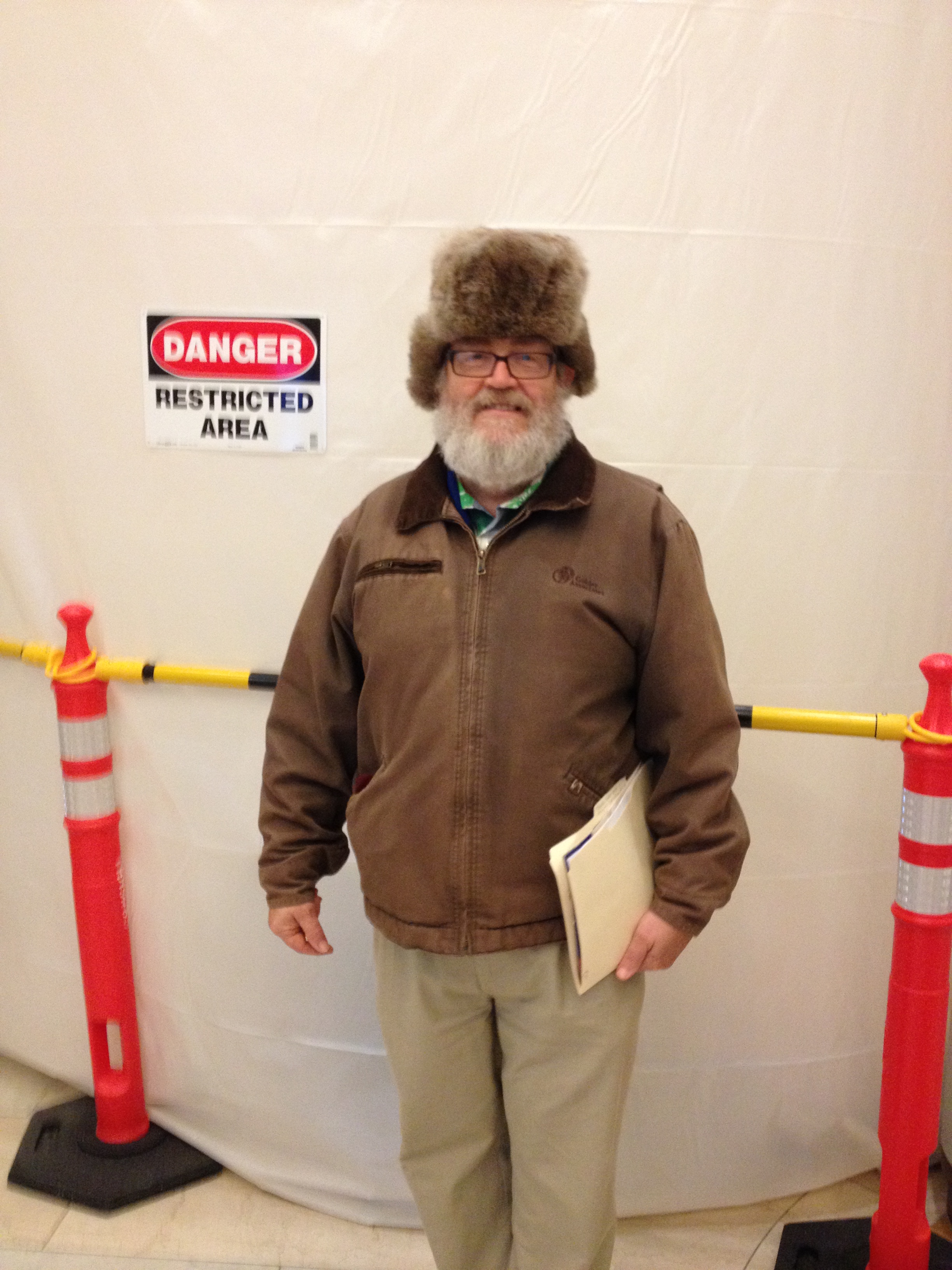

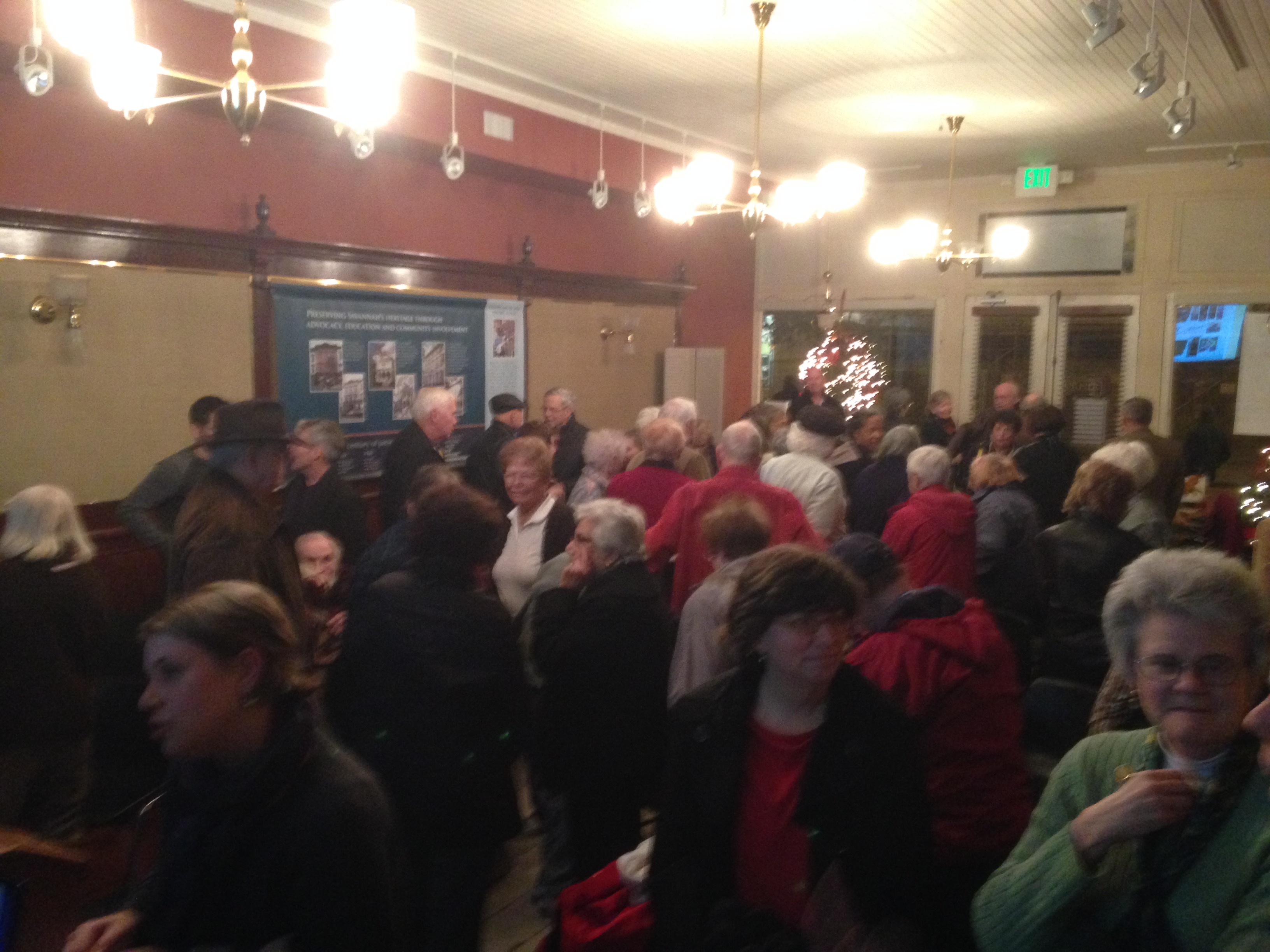


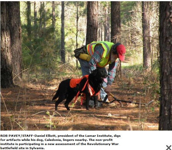
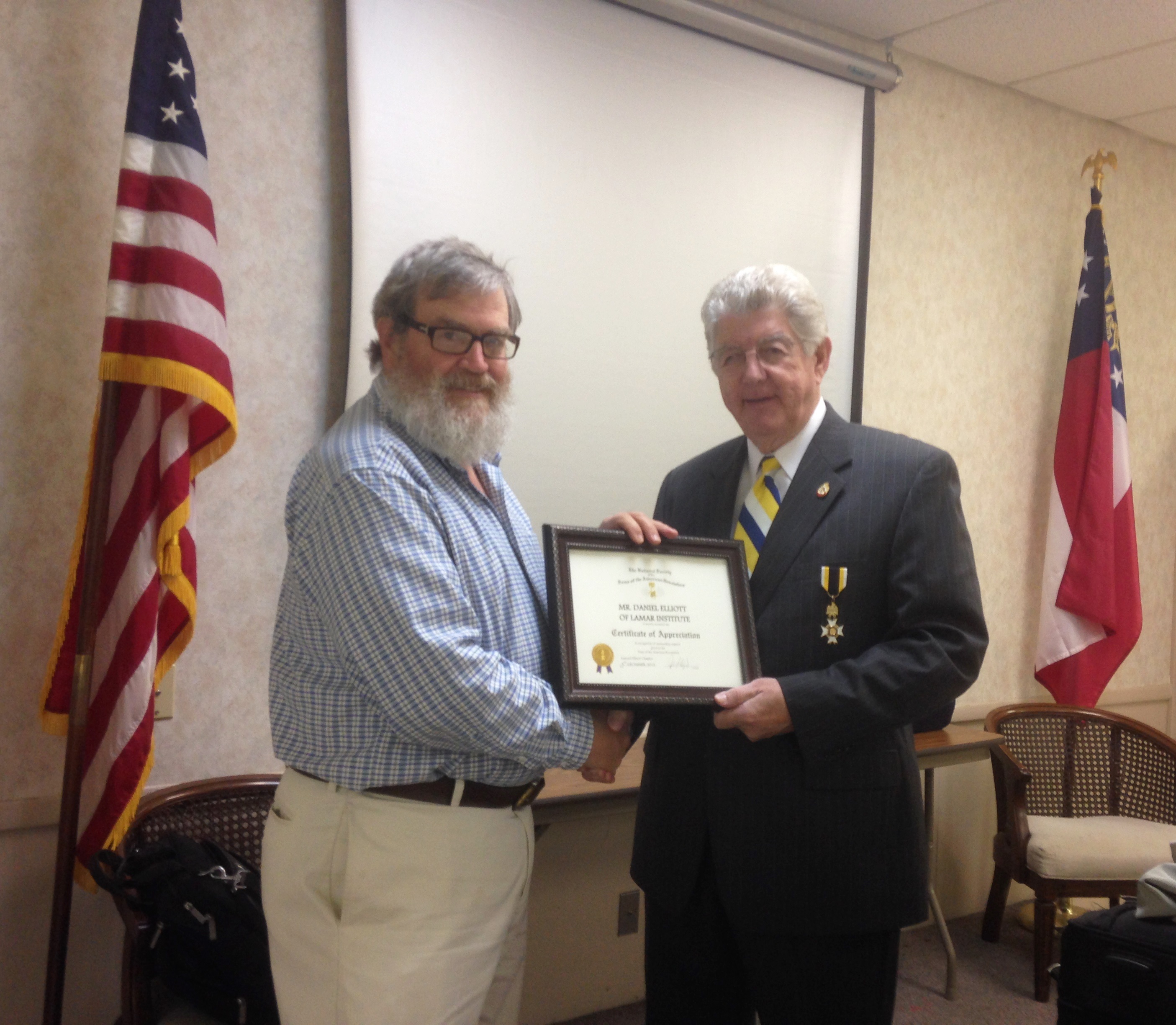
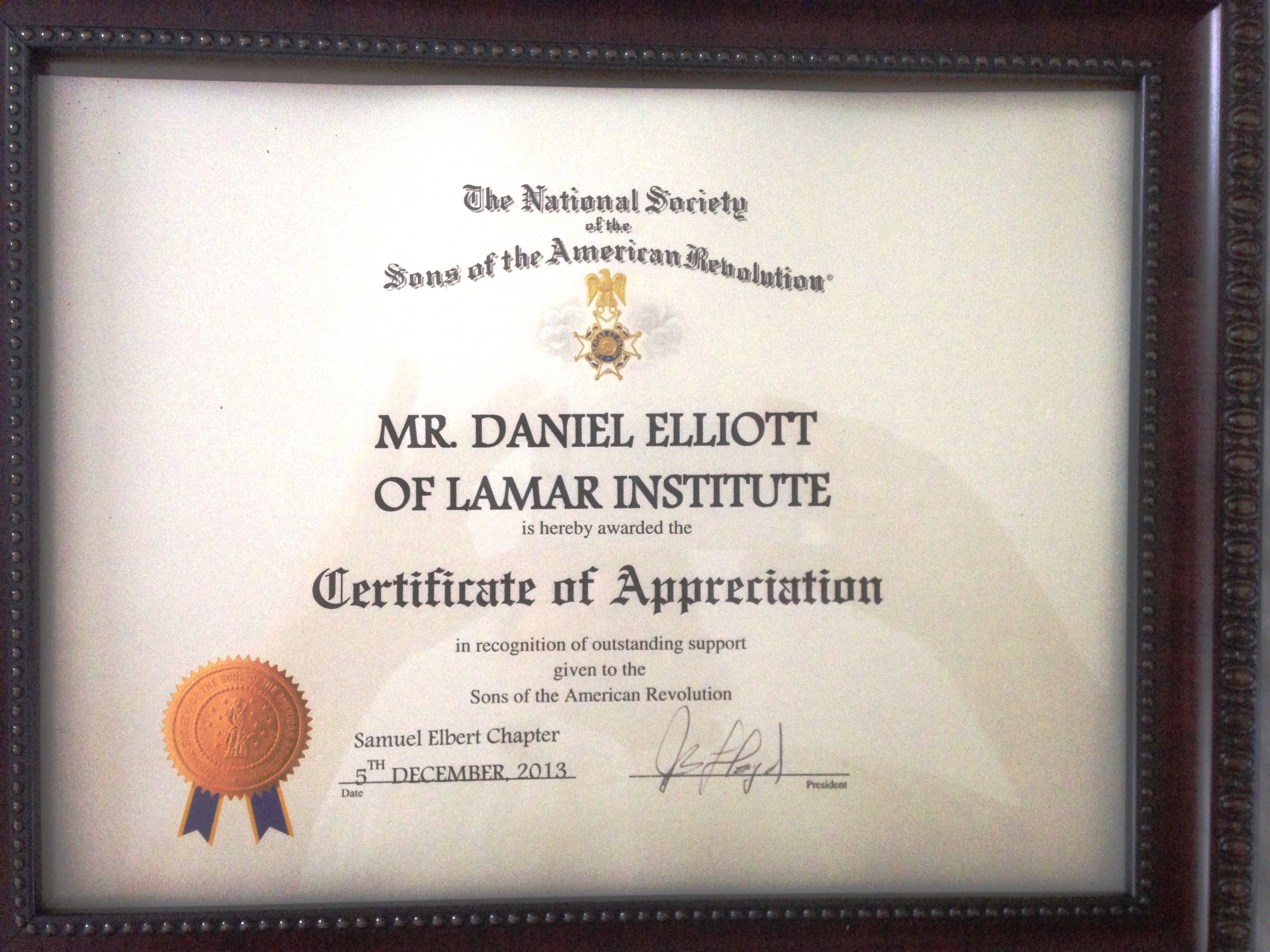


You must be logged in to post a comment.