Past and Current Projects
Oconee Valley Project
The Oconee Valley Project was initiated by Lamar Institute associates Mark Williams and the late Gary Shapiro in the early 1980s with the intent to locate, map, and gather baseline information on all aboriginal mound sites in the Oconee River valley of central Georgia. The project was an offshoot of the University of Georgia’s Lake Oconee salvage project. The project includes archaeological field research at the Copeland site (near Greensboro, Georgia ), the King Bee site (near Eatonton, Georgia), Little River mounds (near Madison, Georgia), the Sawyer site (near Dublin, Georgia), Scull Shoals mounds (near Greensboro, Georgia), Shinholser mounds (near Milledgeville, Georgia), and Shoulderbone mounds (near Sparta, Georgia). The project efforts have since spread to incorporate adjacent watersheds (Savannah River and Ocmulgee River) and include survey, mapping, and test excavation of other aboriginal sites in northern Georgia including: Tate Mound near Elberton, Georgia; Bullard’s Landing Mounds, Browns Mount, and Lamar Mound (near Macon, Georgia); Fortson Mound (near Washington, Georgia); and Ramona’s Mound (near Abbeville, South Carolina). The project also incorporates many surface surveys, which consisted of a systematic search for all archaeological sites within vast timber clearcuts and agricultural fields. Several recent examples of the latter are available on the LAMAR Institute’s website, including reports on the Lindsey, Margaret Ann Bell and Lucky Last sites by Williams and others. Together these excavation and survey data help to reconstruct the patterns of prehistoric settlement in central Georgia on a scale never before witnessed. Most of these excavations and surveys are documented in the Lamar Institute Report Series.
Battlefield Archaeology
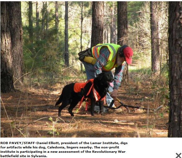
Over the past decade LAMAR Institute researchers have applied battlefield archaeology research techniques to numerous battlefields in the southeastern United States. Beginning in 2001 with a study of Revolutionary War Ebenezer, Georgia, the team explored other Revolutionary War engagements in Kettle Creek, Savannah and Sunbury, Georgia. Colonial military conflict at Sansavilla Bluff was also on their plate. Next came Georgia’s Civil War battlefields at Lovejoy, Monteith Swamp, Dug Gap and Rocky Face Ridge. The team completed a study of portions of the 1814-1815 battle of New Orleans in Chalmette and Meraux, Louisiana. Most recently, the LAMAR Institute’s battlefield research team discovered the lost Revolutionary War battle of Captain Robert Carr’s Fort in Wilkes County, Georgia. Other recently completed LAMAR Institute reports that pertain to fortifications in Georgia include reports on Forts Hollingsworth, Jackson (5 Fathom Hole below Savannah) and Mathews. Reports for the other studies are presently in the LAMAR Institute online report library for free public download.
The next installment in the LAMAR Institute’s battlefield archaeology series is at Purysburg, South Carolina. Historical research for that study of a Revolutionary War headquarters complex and battlefield already is underway thanks to a large research grant from the National Park Service, American Battlefield Protection Program. Fieldwork on the battlefield is scheduled to begin on January 12, 2015. A final report should be available from the LAMAR Institute’s website by early 2016.
Lower Cherokee Towns
Salvage excavations and site stabilization at the Lower Cherokee town of Tamassee, Oconee County, South Carolina were conducted by the Lamar Institute in 1984 in conjunction with the South Carolina Institute of Archaeology and Anthropology (SCIAA), University of South Carolina. The published results of this work are available through the Research Manuscript Series, SCIAA, Columbia, S.C. For information about obtaining digital version sof the Tamassee report, contact Jonathan Leader (S.C. State Archaeologist) at SCIAA.
More recently, Mark Williams has conducted survey and test excavations at other Lower Cherokee towns in northeastern Georgia. These include Estatoe in Stephens County.
Lost City Survey
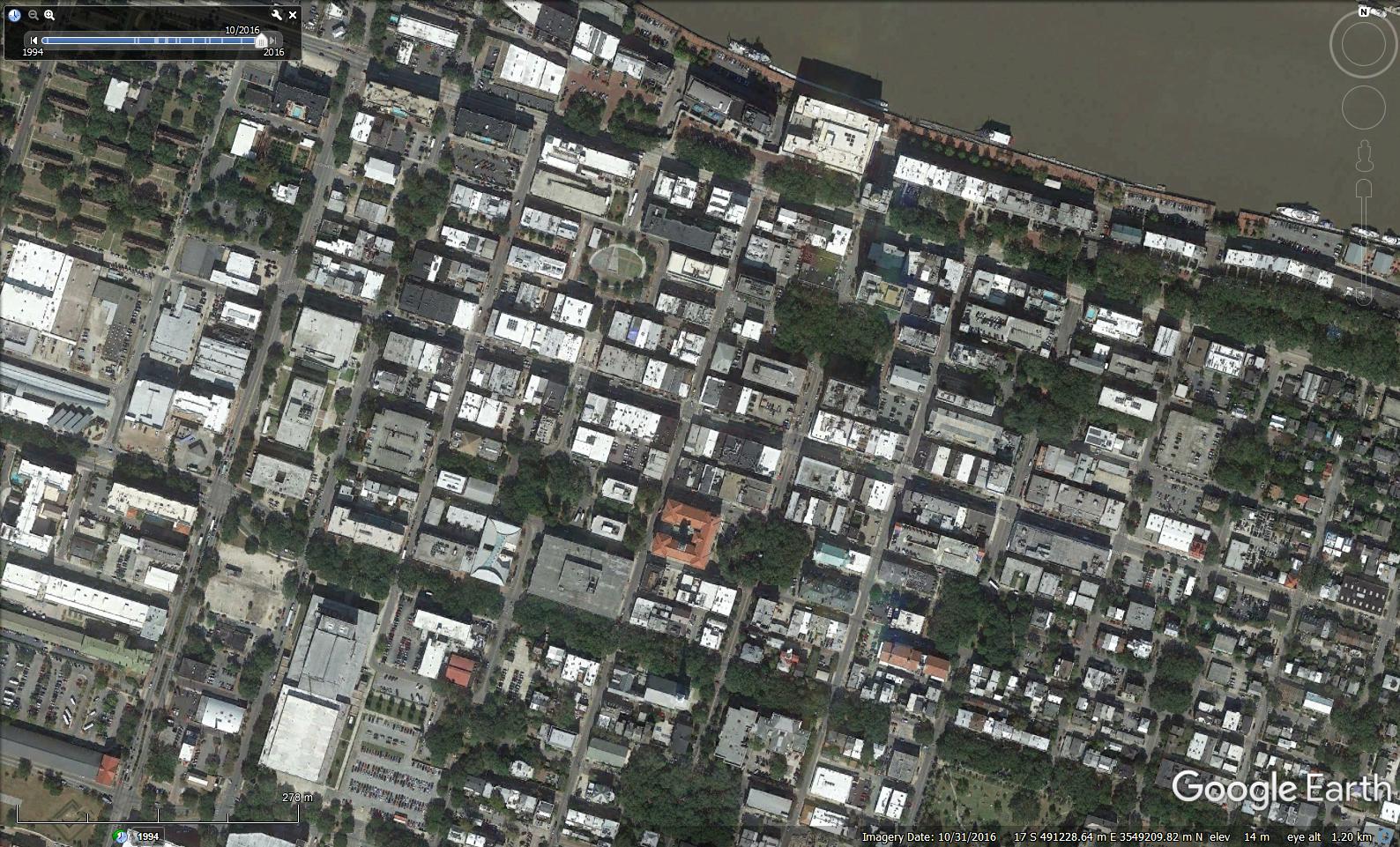
In 1987 the LAMAR Institute launched a research initiative, known as ” Lost City Survey” , which focused on previously unstudied colonial period settlements in Georgia and South Carolina. The centerpiece of this work is New Ebenezer, Georgia, which was a town settled by Pietist Lutherans from the Alps. Survey and Excavations of the colonial town of New Ebenezer, Effingham County, Georgia are ongoing. Survey and/or excavations have been conducted on several other colonial towns in coastal Georgia, including: Abercorn, Bethany, Mount Pleasant, Old Ebenezer, and Vernonburg . The LAMAR Institute, working in cooperation with the Diachronic Research Foundation, Inc., Columbia, S.C., surveyed the site of Jamestown, South Carolina, which was another “dead town” that was founded on the lower Santee River by French Huguenots in 1706. Most of the Lamar Institute’s “Lost City” research is documented in the Lamar Institute Report Series. Many of these towns were discussed more than a century ago in the book, Dead Towns of Georgia, by Charles C. Jones, Jr. The Lost Cities research expanded to include Sunbury in Liberty County and San Savilla in Wayne County, Georgia, which are discussed below. Sunbury is one of C.C. Jones Jr.’s “Dead Towns”, which is now showing signs of new life as a coastal development. Other lost settlements that were the subject of earlier research by LAMAR Institute include Petersburg, Georgia and New Bordeaux and Purysburg, South Carolina. As noted in the Battlefield Archaeology section above, LAMAR Institute researchers have embarked on a new study of Purysburg, which should be completed by 2016.
Plantation Archaeology
Plantation archaeology is an essential part of southeastern historical archaeology. Two adjacent plantations in the Goose Creek section of South Carolina serve to illustrate this aspect of archaeology. Crowfield and Broomhall were two 18th century Goose Creek rice plantations in Berkeley County, South Carolina. In 1987 Garrow & Associates, Inc.conducted archaeological survey of both plantations for Westvaco. The work was underfunded and fast paced. Concurrent work at Broomhall, directed by Steven Byrne was never fully documented. After completing the survey report, Garrow & Associates was contracted to prepare a National Register of Historic Places nomination for Crowfield Plantation. This document was completed and submitted to Westvaco, who promptly filed it away and it was not submitted. That ended the Garrow & associates chapter of Crowfield and Broomhall research. Major portions of these two important and unique 18th century treasures were subsequently trashed by the development project. The mantle was taken up by several other researchers, including: Robert S. Webb Associates, the Chicora Foundation, and Dargan Associates (landscape architects). Several more studies ensued. A summary of work done in a short LAMAR Institute report, see Crowfield and Broomhall.
The reports by Robert S. Webb Associates were produced in very limited quantity, despite their substance and signficiant findings. The Chicora reports on Crowfield and Broomhall plantations are out of print, except for one short study of the gardens at Crowfield as a .pdf file at this website: crowfieldlandscape_chicora102 The other reports by Chicora Foundation are available through Interlibrary Loan. Ms. Barbara Orsolits, M.H.P. created this webpage about Crowfield, as part of a larger study of historical landscape archaeology in the South Carolina low country: http://www.historiclandscape.org/Crowfield%20Overview.htm
Advances on the Internet have provided easy access to additional information on Crowfield, Broomhall, and the Goose Creek plantations. For example, Leiding’s 1921 Historic Houses of South Carolina is available from Books.google.com as a .pdf. It includes a discussion of Crowfield. historic_houses_of_South_Carolina
LAMAR Institute researchers cooperated with the Diachronic Research Foundation in a study of John DelaHowe’s Lethe Farm plantation in McCormick County, South Carolina. The report of that work was produced by the Diachronic Research Foundation. A discussion of the findings also is presented in Carl Steen’s chapter in the University of Alabama Press book, Another’s Country, edited by J.W. Joseph and M. Zierden.
The LAMAR Institute’s endeavors in Plantation archaeology in Georgia include studies at Glen Mary plantation in rural Hancock County, Georgia and the North End plantation and South End Plantation on Ossabaw Island, Chatham County, Georgia. Survey level data for many other Georgia plantations may be found in various LAMAR Institute reports.
Pre-Civil War Forts
Our continuing research initiative, Georgia Pre-Civil War Forts Survey, has made good progress in the past several years. The goal of the initiative is to inventory, locate, and assess military sites in Georgia built prior to 1861. The LAMAR Institute’s inventory of potential military sites in Georgia, dating prior to 1861, presently stands at 328 and growing. Can you name them all?
In 1995 the LAMAR Institute was contracted by Fort Stewart Military Reservation to conduct historical research and excavations at Fort Argyle in Bryan County, Georgia. Fort Argyle was a small colonial fort on the Ogeechee River, which lasted from 1734 to 1758.
In 2001 the LAMAR Institute delved into the Revolutionary War archaeological sites in coastal Georgia. These projects, which are part of the institute’s “Pre-Civil War Forts Initiative”, seek to identify, protect, and interpret important fort and battlefield sites in this region of Georgia. This project was boosted with the generous support of the National Park Service’s American Battlefield Protection Program (ABPP). The LAMAR Institute was awarded research grants from the ABPP in 2001 to explore New Ebenezer’s role as a headquarters for the American Patriot and British armies who were engaged in the Southern campaigns in 1778 to 1783. The “Ebenezer Revolutionary War Headquarters” project identified many important fortifications, defensive trenches, campsites, graves, and other archaeological resources. Historical research was a vital component in this research effort. That work, which was conducted from January 2002 to December 2002, resulted in: detailed topographic mapping of the town and associated earthworks, ground penetrating radar survey of selected parts of town, and extensive historical research. The product is a greatly enriched understanding of Revolutionary War history in Georgia that should provide great research context for this period of Georgia history. The Ebenezer report is available online at Ebenezer Headquarters . The LAMAR Institute furthered the goals of the Forts Initiative in 2003 when they were awarded three additional research grants. These included ABPP grants for Sunbury Battlefield and the Fort Mount Venture/Sansavilla Bluff Massacre, and a small grant from the Plum Creek Foundation for Fort Mount Venture.
In February 2003, researchers with the LAMAR Institute conducted a preliminary archaeological reconnaissance of Sansavilla Bluff on the Altamaha River in Wayne County,Georgia. This property, which is currently owned by the Plum Creek Timber Company, contains a concentration of early historic and prehistoric sites that have been too long neglected. Three new archaeological sites were recorded and several previously recorded sites were revisited. The finds include the village of Williamsburg (circa 1790-1810) and the probable site of Fort Mount Venture (Mary and John Musgrove’s 1730s trading post. Fort Mount Venture was attacked, burned, and its inhabitants nearly all killed by Spanish-allied Yamassee Indians in 1742. This site, which was allegedly located in the 1960s by University of Georgia archaeologists (but not officially reported or recorded), promises to be one of the most significant sites in colonial Georgia. In March 2003 the LAMAR Institute conducted a reconnaissance survey of a 4 acre tract at Hudson’s Ferry in Screven County, Georgia. Hudson’s Ferry was a major British post in 1779 and is a place rich in history. The Sunbury report is available at Sunbury . Related information on nearby Fort Morris is also available online from the Georgia Department of Natural Resources. The Sansavilla Bluff report is available at Sansavilla Bluff. The Hudson’s Ferry report is available at Hudson’s Ferry . LAMAR Institute research on the fortifications of Camden County, Georgia were fast-forwarded when a planned residential development and marina threatened the late 18th and early 19th century U.S. Army post at Point Peter. Subsequent historical and archaeological research at Point Peter was undertaken by the firm of Brockington & Associates. The LAMAR Institute’s preliminary introduction to the Camden County forts is available in the online report at Point Peter.
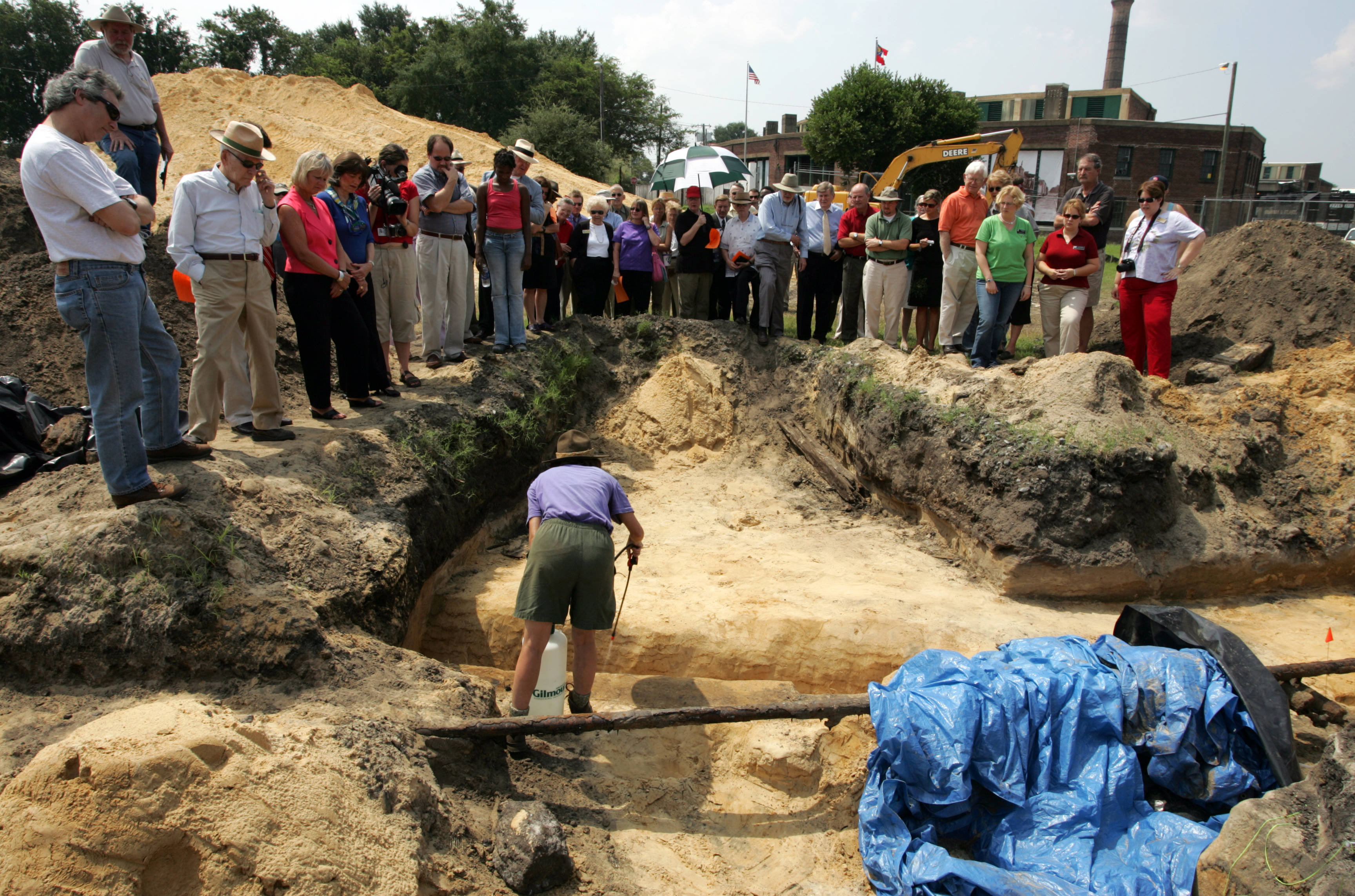
The recent endeavor of the LAMAR Institute’s Fort’s Initiative are the excavations at Fort Hawkins in Macon, Georgia. Fort Hawkins was a major United States Army headquarters post from 1806 to 1821. It also served as the primary “factory” in the southern Indian trade. LAMAR Institute researchers are studying the site through historical documents and excavation and a detailed summary of this active project is presented at our News page and at the website: forthawkins.org.The LAMAR Institute’s involvement at Fort Hawkins began in August, 2005 and continues to the present. In 2014, the City of Macon and the Fort Hawkins Commission unveiled its Fort Hawkins Visitor’s Center.
Most recently the LAMAR Institute conducted field research at three eighteenth century fortifications in northern Georgia. These include GPR sampling at Forts Mathews (Oconee County) and Hollingsworth (Banks County) and an in-depth battlefield survey at Captain Robert Carr’s Fort (and surrounding cultural landscape) in Wilkes County.
Skeletons in the Closet
Another research focus, the Skeletons in the Closet Initiative, also reports significant progress. The goal of this initiative is to root out the history of early Georgia archaeology and its archaeologists and introduce them to the people of the 3rd Millenium.
Mark Williams has made significant strides by creating a biographical file on Georgia archaeologists. Williams also has been ferreting out the facts on the Irene Mound excavations of the 1930s. The reanalysis of the Irene Mound collections, funded by the National Park Service and implemented by the University of Georgia’s Laboratory of Archaeology, is but one example of the LAMAR Institute’s initiative.
Since 1981 Daniel Elliott has been in dogged pursuit of one of Georgia’s first archaeologists, Roland Steiner. The initial trail led him to the Smithsonian Institution in Washington, D.C. where a massive relic collection was discovered. The Smithsonian Institution’s Steiner collection once numbered more than 78,000 items. Most of it was acquired by the museum following a Resolution passed in the House of Representatives in the U.S. Congress. Although the precise number of remaining artifacts with Steiner’s provenance is unavailable, the Smithsonian’s curatorial staff estimated it to be about 35,000 items.
Following up on clues found in his Smithsonian Institution research, Dan Elliott conducted a reconnaissance inspection of the 19th century Georgian Roland A. Steiner collection at the Field Museum of Natural History, Chicago in April 1999 and in February 2002 he examined the files pertaining to Georgia collections at the American Museum of Natural History (AMNH), New York. The Field Museum collection contains about 2,000 artifacts from Georgia. Nearly all of these were collected by Roland Steiner. The Field Museum originally purchased more than 15,000 artifacts from his collection. Obviously the collection was greatly reduced over the century that followed.
About another 20,000 artifacts from Roland Steiner’s collection wound up at the AMNH, thanks to the generosity of George Foster Peabody. Steiner was nearing the end of his life and needed to sell the collection. Peabody, who was a native Georgian, purchased the collection for the museum. Dan Elliott, accompanied by Rita Elliott spent one week studying the Georgia collections at the AMNH through a visiting scholar grant from the museum. Like Steiner’s other collection, the AMNH collection has dwindled through the years as many items from the collection were exchanged with other museums, discarded, or otherwise deaccessioned. The AMNH collection also includes major collections by Charles C. Jones, Jr., Roland Steiner, George Foster Peabody, Robert Wauchope and others. To learn more about Roland Steiner and his exploits, click here for the first installment of the Roland Steiner Project, which includes introductory background information and transcribed correspondence and other paper documents relating to Steiner and his works.
While researching Roland Steiner’s collection at the Smithsonian Institution, Dan Elliott stumbled across a lesser known figure in Georgia Archaeology–William McGlashan. McGlashan worked as a civil engineer for the Georgia Railroad and was responsible for re-routing a section of track in the Ogeechee River watershed in the late 1830s or early 1840s. During that work, McGlashan personally collected, or had the railroad workers under his charge bring to him, curious Native American relics that were unearthed by the construction. At the time of Elliott’s “discovery” of the McGlashan horde these artifacts were being decontaminated for asbestos. It seems that many of McGlashan’s artifacts (as well as a portion of Steiner’s artifacts) had been stored in the attic of the Smithsonian “Castle”. These particular relics were not available for research at that time, although Elliott gathered some documentary background on McGlashan and his collecting activity for future reference. That material was published as a LIPS report. Physical examination of materials collected by McGlashan, which remain in curation at the Smithsonian Institution Suitland, Maryland facility, is on the LAMAR Institute’s wish list.
Another important collection in the Suitland, Maryland facility of the Smithsonian Institute is Preston Holder’s collection from his WPA Glynn County, Georgia Excavation Project. Preston Holder (born September 10, 1907 and died June 3, 1980) had a long career in anthropology as a professor at the University of Nebraska-Lincoln, although his stint in Georgia archaeology was very brief and sadly under-reported. Dan Elliott also gathered documentary information about Holder’s excavations, which were contained in the Antonio Waring papers in Suitland. Elliott briefly perused the artifact drawers that contained many artifacts from Holder’s excavations at the Airport site, which at that time were still curated at the National Museum of Natural History on the Mall in Washington, DC. These items have since been transferred to the Suitland facility.
Kevin Kiernan also took notice of Preston Holder’s unreported coastal Georgia WPA archaeology project, which he summarized as a chapter entitled, “Preston Holder’s WPA Excavations in Glynn and Chatham Counties, Georgia, 1936-1938”, in a recent publication, entitled: Shovel Ready: Archaeology and Roosevelt’s New Deal for America, edited by Bernard K. Means (The University of Alabama Press, Tuscaloosa, 2013). See also a short summary of Kiernan’s study on Holder in the November 2011, The SAA Archaeological Record, which is available online. Holder’s actual artifact collection from numerous sites on St. Simons Island, Sea Island and the adjacent mainland remain to be analyzed, however, and it continues to hold great secrets about the Terminal Archaic and Woodland period on Georgia’s barrier islands. The recent rattling his skeletons in Holder’s closet has attracted the attention of several scholars on coastal Georgia archaeology.
Some of the Skeletons in the Closet are literally in the closet. Mark Williams and Dan Elliott began the Bettye Broyles Repatriation Project (another chapter in the Skeletons in the Closet Initiative) in the Spring, 2000. Bettye is an archaeologist who has made many contributions to our understanding of prehistory and history in the eastern U.S. She also has excellent artistic skills and these skills were sought out by many southeastern archaeologists. Williams and Elliott drove to Bettye’s house near Chattanooga and had a nice visit before attacking a stash of cardboard boxes in her hillside garage. These boxes contained artifacts from a number of Swift Creek sites in Georgia, as well as a few stray boxes from Cahokia and elsewhere. Broyles had obtained the materials in the early 1960s and her SEAC Bulletin on Swift Creek design motifs was based on these materials. The collection includes a 1/2 pick-up truckload of sherds from famous sites such as: Fairchild’s Landing, Halloca Creek, Kolomoki, Mandeville, Milamo, and Swift Creek. Ms. Broyles gave the materials to us for safekeeping and we immediately transferred the collection to the Laboratory of Archaeology at the University of Georgia, Athens. Bags and boxes that were in tatters were transferred into new bags and carefully relabeled by Williams’ student workers. Many sherds in this collection are exquisite examples of Swift Creek art and are good candidates for a museum exhibit. Obviously, the ownership of the material is an issue that needs to be worked out. If the rightful owners of the materials request them back and can demonstrate that the material will be properly curated this time, then the LAMAR Institute most likely will be willing to repatriate them.
Ms. Broyles also graciously allowed the LAMAR Institute team to photocopy hundreds of Swift Creek design tracings that she had compiled. She intends for the original drawings to be donated to the National Anthropological Archives (NAA), American Museum of Natural History, Smithsonian Institution in the future. The vast majority of these designs are unpublished and we look forward to reproducing them in an upcoming Swift Creek “Pattern” Book. Time did not allow us to complete the photocopying and hundreds of tracings of sherds from the Kolomoki site remain to be copied. Broyles promised to complete the job for us, but many months have passed now and we probably should make a second trip to her house soon.
Ms. Broyles also has a collection of 8-track sound recordings of nearly all Southeastern Archaeological Conference (SEAC) meetings that she attended in the early years. She plans to donate these priceless tapes to the NAA as well. Although her mind is quite clear, age is creeping up on Bettye and hopefully, she will have an opportunity to organize her papers. Since our conversations with Ms. Broyles were “off the record” she imparted many great stories about Southeastern archaeologists to the two of us, which we will treasure always. Ms. Broyles also demonstrated her tedious, time-consuming, conservative techniques for reconstructing pottery designs, which was fascinating.
[NOTE: Bettye Jeane Broyles, born on August 16, 1928, left this world on March 27, 2011.]
Among the many interesting collections from Georgia, which are housed at the curation facility in Suitland, Maryland is one from the Greenwood Mound (or Dillard Mound) in Rabun County. The Greenwood Mound is located near the headwaters of the Little Tennessee River. An obscure archaeologist named William Colburn conducted excavations at Greenwood Mound in the 1930s, which produced one short journal article describing the site. The Greenwood Mound collection at the Smithsonian was briefly reconnoitered and Elliott provides a transcription of Colburn’s field report with additional comments by Elliott regarding their excavated context in a LIPS Report.
Also, recent advances in the digital records and holdings in the Smithsonian Institution Research Information Search (SIRIS) database at the Smithsonian Institution has alerted us to many new avenues for research on Georgia’s early archaeology. Ultimately, we hope to make the Skeletons in the Closet speak. Be sure to check out the recent reprint of Clarence Bloomfield Moore’s classic volume on Georgia archaeology, which also contains a lengthy introduction by Lewis Larson, at The University of Alabama Press. Moore’s original monograph is also available in .pdf format by clicking here, and here. And more information on Georgia’s early archaeologist is available from Fernbank Museum.
Southwestern Georgia Studies
Kolomoki, located in the uplands of Early County, Georgia, is a long misunderstood Woodland mound center. Excavations in the 1960s at Kolomoki by William Sears and students with the University of Georgia, Department of Anthropology, resulted in a series of excavation reports on the site. Shortly before his death, however, Sears recognized his erroneous interpretation of the site, which he revealed in his famous American Antiquity article. Sears’ confession, plus the results of the LAMAR Institute’s 1993 Swift Creek conference and subsequent publication, set the stage for a reexamination of the Kolomoki site and its role in Woodland society. Tom Pluckhahn reports that great progress is being made at Kolomoki. Portions of Tom’s dissertation work at Kolomoki were funded by the LAMAR Institute. The Kolomoki Mound group is an extremely important archaeological site in Early County, Georgia. Pluckhahn is a Research Associate of the LAMAR Institute. One important aspect of Pluckhahn’s research was a review of previous work conducted at this important Woodland period mound complex. His fieldwork explored many new parts of the mound center and resulted in an innovative interpretation of the site. Dr. Pluckhan recently accepted a teaching position in Oklahoma, although we expect his interest in the archaeology of Georgia and the Southeast to continue to flourish. Pluckhan’s dissertation research was recently published by the University of Alabama Press. The LAMAR Institute is proud to have supported, in small part, the Kolomoki Mounds Archaeological Project.
Another research initiative, the Flint River Basin Archaeological Survey, evolved from LAMAR Institute’s archaeological survey research in southwestern Georgia for the Georgia Department of Natural Resources, Historic Preservation Division. Reconnaissance level survey and relic collector interviews yielded almost 400 previously unrecorded sites in 14 counties of southwestern Georgia. Most of these were located in the Flint River watershed. The LAMAR Institute conducted an archaeological reconnaissance survey of 14 counties in southwestern Georgia, under contract with the Historic Preservation Division, Georgia Department of Natural Resources. The counties under study included Baker, Calhoun, Colquitt, Decatur, Dougherty, Early, Grady, Lee, Miller, Mitchell, Seminole, Terrell, Thomas, and Worth. The reconnaissance resulted in a substantial increase in the known universe of archaeological sites in this region of Georgia. Before the survey slightly more than 1,200 sites were recorded in these 14 counties and after the survey was done, more than 1,500 sites were added to the inventory. Also, a preliminary survey of relic collectors and their collections (relevant to these 14 counties) was completed. The Flint River Basin Archaeological Survey (FRBAS), which was launched in July 2004, expanded the study to include 42 counties in the Flint River watershed. The full report is available at FRBAS Report.
Golden Isles
The most recent research initiative by the LAMAR Institute is the Golden Isles Initiative. This research is part of a recent “rediscovery” of the wealth of historic period archaeological sites contained on Georgia’s barrier islands. LAMAR Institute researchers teamed up with the Ossabaw Island Foundaiton and the Georgia Department of Natural Resources in a study of the North End Plantation on Ossabaw Island. This research was funded in part by a grant from the National Park Service’s “Save America’s Treasures ” program, as well as generous funds from the Robert Woodruff Foundation and other donors. Two studies were conducted at this plantation site in early 2005 and another was conducted in early 2006. The reports of the 2005-2007 research are available at North End Plantation (1) and North End Plantation (2).
LAMAR Institute researchers have also been busy at Jekyll, St. Catherines, St. Simons, Tybee Islands, and Cumberland Islands. Ground Penetrating Radar (GPR) surveys, survey, test excavations, and historical research are aspects of this exciting research. At Jekyll Island, researchers assisted archaeologists with Southern Research Historic Preservation Consultants, Inc. and the Jekyll Island Authority in their study of the Captain William Horton plantation–a colonial plantation and tabby ruins.
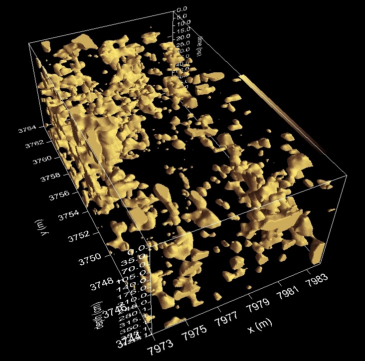
On St. Simons Island LAMAR Institute researchers, assisted by Georgia Department of Natural Resources archaeologist Jason Burns, conducted a shovel test survey and GPR survey on property of the Coastal Georgia Historical Society near the St. Simons Lighthouse. LAMAR Institute researchers also used GPR to examine a portion of Button Gwinnett’s plantation home on St. Catherines Island. LAMAR Institute researchers excavated beneath the Assistant Keeper’s house at Tybee Lighthouse. The GPR survey report for the Horton house was produced as an appendix in Southern Research’s technical report. The Tybee report is available online as an Adobe .pdf file at Tybee Report . The reports on the work at St. Catherines Island is pending. LAMAR Institute archaeologists assisted archaeologist Carolyn Rock on the northern end of Cumberland Island in a search of the remains of colonial Fort St. Andrews. Rock had covered the area with systematic shovel tests, which had tentatively located the site. The team used GPR survey technology to map portions of the suspected fort site, which is detailed in our Fort St. Andrews GPR report. Subsequent test excavations by the National Park Service confirmed the remains of the fort and data recovery excavations to salvage threatened portions of the site were conducted in the Spring of 2009. LAMAR Institute researchers, Dan Battle, Dan Elliott and Rita Elliott served as volunteers in the 2009 project. Dan and Rita Elliott also volunteered for service at Fort St. Andrews during the NPS, SEAC’s 2014 excavation season. We look forward to NPS archaeologist Meredith Hardy’s report on these important excavations at one of colonial Georgia’s most important coastal defenses.
Hands Across the Water
And speaking of oceans, water is no barrier for archaeological knowledge as demonstrated by two LAMAR Institute projects. In September 2007 Dan Elliott and Rita Elliott conducted test excavations at the Freetown Cemetery on Grand Bahama Island. This project was divided into two phases. The primary goal was to “ground truth” the results from an earlier Ground Penetrating Radar survey of the Freetown cemetery and its surroundings that was conducted in July, 2007 by Dean Goodman and Kent Schneider. This phase consisted of creating a detailed topographic map of the site and all above-ground cultural features and excavation of nine 2 m by 1 m test units on a variety of features and non-feature areas. The second phase of the project was a brief reconnaissance of the Freetown settlement, which is an abandoned settlement located west of the cemetery. This village, which is thought to date to the 1830s and lasting into the 1960s, consists of a series of ruins and archaeological deposits now vegetated in jungle.The results of this research effort were documented in a Freetown Cemetery report.
In September, 2008 Dan Elliott and Rita Elliott taught a Ground Penetrating Radar demonstration class in Saipan, Commonwealth of the Northern Mariana Islands last week. Eighteen people attended the class, including representatives of the CNMI Historic Preservation Office, other CNMI agencies, utilities, and a private consulting firm. Special thanks to Roy Sablan, Jr. and his staff for making our stay very pleasant. Highlights included field surveys at three historic site locations on the island: a suspected Carolinian cemetery, the old Japanese Jail, and the old Japanese Hospital.
In addition, we took our GPR equipment to Kalabera Cave on Saturday (our day off!) and did a survey of two areas. We were assisted by archaeologists Marilyn Swift, Randy Harper, and Mike Fleming, all of whom (Swift and Harper Archaeological Resource Consultants) are currently involved in an Environmental Assessment of the cave and its surroundings. This represents the first research/educational effort by the LAMAR Institute in the Pacific arena.
Recent collaboration by the LAMAR Institute and the University of Tennessee-Chattanooga at the Scarlett Mound site on Ossabaw Island, Georgia is summarized in a LIPS Report. This curious earth mound is located on the northern end of this barrier island and this report details the first archaeology work done there. The study included topographic mappings, shovel testing, excavation of one test unit and GPR survey. Even after these preliminary studies, however, the site holds many mysteries.
Educational Outreach
Since its founding the LAMAR Institute has maintained a strong involvement in developing ways to mesh archaeology with K-12 education curricula. By trial and error our educational coordinators have learned that this is optimally achieved by educating teachers. The LAMAR Institute has co-sponsored teachers workshops on archaeology with the University of Georgia, Department of Anthropology; USDA Forest Service, Chattahoochee-Oconee National Forest; the University of South Carolina’s Savannah River Archaeological Research Project, South Carolina Institute of Archaeology and Anthropology, Aiken; Emory University, Decatur; and the Old Governor’s Mansion, Georgia College, Milledgeville. In recent years, these courses have been led by Rita Elliott and included lectures by numerous regional scholars, videos, hands-on activities, selected readings, and field trips to archaeological sites and an archaeological laboratory.
The LAMAR Institute has played an active role in the planning and development of Georgia Archaeology Week and Georgia Archaeology Month. For the 1996 Georgia Archaeology Week, the LAMAR Institute was a major sponsor of the event. New Ebenezer served as the focal point of the festivities, as highlighted in the poster, shown below, which was distributed to more than 2,000 schools and libraries state-wide.
Rita Folse Elliott was responsible for the development of innovative teaching materials for the 2003 Georgia Archaeology Month. A booklet for educations, authored by Ms. Elliott, was distributed along with copies of a video to schools and libraries throughout Georgia. This project was funded by the Georgia Ports Authority and the work accomplished by Ms. Elliott and others with the private firm of Southern Research Historic Preservation Consultants, Inc., Ellerslie, Georgia. The Society for Georgia Archaeology is the main sponsor Georgia Archaeology Month and Ms. Elliott has continued to develop the archaeological curriculum for Georgia Archaeology Month in the years since 2003. Since 1996, the LAMAR Institute has continued to serve as one sponsor of this event whenever funds permit.
In 2000, LAMAR Institute educators became involved in Fort Frederica National Monument’s “Colonial Classroom” education project. This unique educational program, led by Ellen Provenzano, offers 4th Graders and their teachers in the Glynn County school system an opportunity for real archaeological experience. More information on this wonderful project can be found at Colonial Classroom and at Shiner’s Trench .
Ellijay Middle School Project
At the Ellijay Middle School in Gilmer County, Georgia, excavations directed by archaeologists Rita Elliott and Dean Wood and Ellijay Middle School teachers Cindy Zager and Linda Smith revealed a multi-component aboriginal settlement on the school’s athletic field. Three seasons of excavation were conducted by the Ellijay team. The students’ archaeological field experience was preceded by weeks of classroom study. The teachers, who were recent graduates of a Michael C. Carlos Museum (Emory University)/LAMAR Institute teacher’s seminar, developed creative ways to incorporate archaeological concepts and techniques in the requisite curriculum. The students participated in excavation, artifact cleaning and preliminary sorting analysis. The first two seasons were spent in the school’s athletic field but the final season included a brief visit to a nearby aboriginal site. Reports of these excavations will be available to the public through the Lamar Institute publication series. Meanwhile check out this older paper, which highlights the Ellijay Project, as presented by Rita Elliott to the Society for Georgia Archaeology.
Material Culture Studies
LAMAR Institute researchers have a variety of interests in various material culture types. Gunflints provide one example of an artifact type that can be explored on various dimensions. More information on LAMAR Institute’s gunflint studies may be found by following this link: GUNFLINTS.


 Mary Landers’ Savannah Morning News article:


You must be logged in to post a comment.